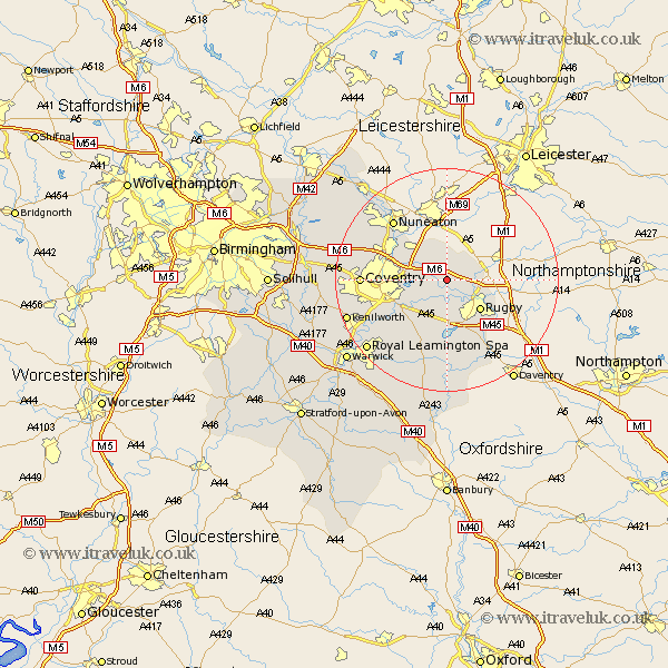
Warwickshire Map Showing Location of Stretton
Population: 185
District: Rugby
Easting: 445336 Northing: 280106
Latitude: 52.42 Longitude: -1.33
 = Stretton
District: Rugby
Easting: 445336 Northing: 280106
Latitude: 52.42 Longitude: -1.33
= Stretton
This Stretton map below is supplied by Google. Use the tools in the top left corner to zoom into street level or zoom out for a road map, you may also need to zoom in to see Stretton on the map. Click and drag the map to move around. If the map fails to load try and refresh your browser or zoom in or out (+ or -).
Update - it seems Google no longer allow people to use their maps for free! This Stretton map sometimes loads and sometimes gives a error. I am working on a solution.
Closest 30 Towns or Cities to Stretton (Population over 500)
Brinklow 2.17km Shilton 5.84km Long Lawford 6km Wolston 6.51km Brandon 7.17km Wolvey 7.74km Bulkington 7.93km Rugby 7.93km Clifton-on-Dunsmore 8.74km Clifton upon Dunsmore 8.74km Clifton 8.74km Clifton on Dunsmore 8.74km Dunchurch 9.87km Bedworth 10.61km Baginton 11.6km Bubbenhall 12.96km Keresley 13.69km Nuneaton 14.33km Stoneleigh 14.49km Allesley 14.69km Coventry 14.69km Corley 15.15km Stockton 16.72km Long Itchington 17.02km Fillongley 17.83km Kenilworth 18.52km Leamington 18.78km Royal Leamington Spa 18.78km Leamington Spa 18.78km Southam 18.84km