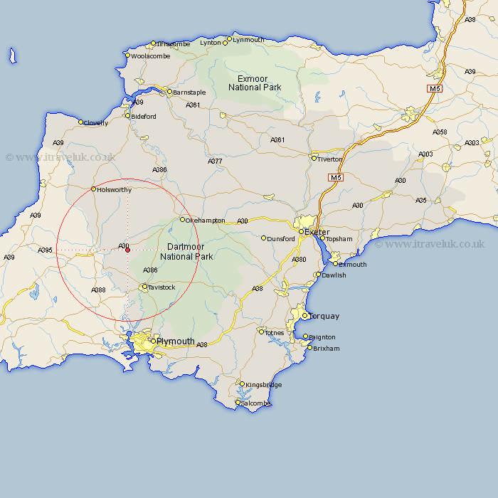
Devon Map Showing Location of Stowford
Population: 282
District: West Devon
Easting: 243312 Northing: 85777
Latitude: 50.65 Longitude: -4.22
 = Stowford
District: West Devon
Easting: 243312 Northing: 85777
Latitude: 50.65 Longitude: -4.22
= Stowford
This Stowford map below is supplied by Google. Use the tools in the top left corner to zoom into street level or zoom out for a road map, you may also need to zoom in to see Stowford on the map. Click and drag the map to move around. If the map fails to load try and refresh your browser or zoom in or out (+ or -).
Update - it seems Google no longer allow people to use their maps for free! This Stowford map sometimes loads and sometimes gives a error. I am working on a solution.
Closest 30 Towns or Cities to Stowford (Population over 500)
Broadwoodwidger 4.38km Lifton 5.05km Milton Abbot 6.04km St. Giles-on-the-Heath 9.02km St Giles 9.02km St. Giles on the Heath 9.02km Saint Giles 9.02km Saint Giles-on-the-Heath 9.02km St Giles-on-the-Heath 9.02km Saint Giles on the Heath 9.02km St. Giles 9.02km St Giles on the Heath 9.02km Bridestowe 9.02km Lamerton 9.56km Ashwater 10.38km Tavistock 12.07km Gunnislake 12.98km Halwill 13.03km Whitechurch 14.25km Whitchurch 14.25km Northlew 14.76km Buckland Monachorum 17.69km Okehampton 17.86km Walkhampton 18.22km Horrabridge 18.6km Black Torrington 18.68km Holsworthy 20.77km Yelverton 20.79km Pyworthy 21.09km Hatherleigh 21.33km