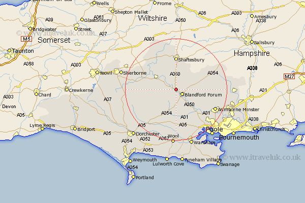
Dorset Map Showing Location of Stourpaine
Population: 608
District: North Dorset
Easting: 385932 Northing: 109392
Latitude: 50.88 Longitude: -2.2
 = Stourpaine
District: North Dorset
Easting: 385932 Northing: 109392
Latitude: 50.88 Longitude: -2.2
= Stourpaine
This Stourpaine map below is supplied by Google. Use the tools in the top left corner to zoom into street level or zoom out for a road map, you may also need to zoom in to see Stourpaine on the map. Click and drag the map to move around. If the map fails to load try and refresh your browser or zoom in or out (+ or -).
Update - it seems Google no longer allow people to use their maps for free! This Stourpaine map sometimes loads and sometimes gives a error. I am working on a solution.
Closest 30 Towns or Cities to Stourpaine (Population over 500)
Stourpaine 0km Blandford 2.98km Blandford Forum 2.98km Shillingstone 3.97km Child Okeford 4.39km Pimperne 4.68km Iwerne Minster 5.68km Stickland Winterborne 6.03km Winterborne Stickland 6.03km Sturminster Newton 6.92km Fontmell Magna 7.51km Tarrant Monkton 8.39km Spetisbury 9.44km Whitechurch 9.55km Milton Abbas 10.96km Charlton 12.06km Marnhull 12.37km Stour Provost 12.56km Winterborne Kingston 12.96km Shaftesbury 12.98km Stalbridge 13.84km Milborne Saint Andrew 14.22km Milborne 14.22km Milborne St Andrew 14.22km Milborne St. Andrew 14.22km East Stour 14.23km Stour 14.23km Sturminster Marshall 14.54km Bere Regis 14.87km Motcombe 14.88km