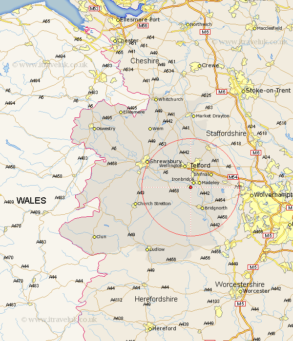
Shropshire Map Showing Location of Broseley
Population: 5044
Area Size (ha): 131
District: Bridgnorth
Easting: 367280 Northing: 302252
Latitude: 52.62 Longitude: -2.48
 = Broseley
Area Size (ha): 131
District: Bridgnorth
Easting: 367280 Northing: 302252
Latitude: 52.62 Longitude: -2.48
= Broseley
This Broseley map below is supplied by Google. Use the tools in the top left corner to zoom into street level or zoom out for a road map, you may also need to zoom in to see Broseley on the map. Click and drag the map to move around. If the map fails to load try and refresh your browser or zoom in or out (+ or -).
Update - it seems Google no longer allow people to use their maps for free! This Broseley map sometimes loads and sometimes gives a error. I am working on a solution.
Closest 30 Towns or Cities to Broseley (Population over 500)
Ironbridge 2.16km Barrow Bridge 2.17km Barrow 2.17km Madeley 3.85km Much Wenlock 4.87km Dawley 5.67km Telford 7.78km Cressage 9.19km Ketley 9.26km Hadley 9.26km Wellington 9.53km Shifnal 9.64km Oakengates 9.86km Bridgnorth 10.31km Worfield 10.82km Wrockwardine 10.83km Trench 11.18km Downington 11.62km Donnington 11.62km Lilleshall 14.13km Ditton Priors 14.15km Albrighton 14.74km Berrington 15.08km Claverley 15.48km Rodington 15.78km Woodcote 16.44km Cherrington 16.72km Ercall Magna 16.78km High Ercall 16.78km Edgmond 17.27km