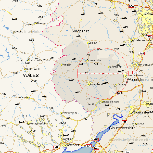
Herefordshire Map Showing Location of Stoke Lacy
Population: 349
Easting: 361217 Northing: 248530
Latitude: 52.13 Longitude: -2.57
 = Stoke Lacy
Easting: 361217 Northing: 248530
Latitude: 52.13 Longitude: -2.57
= Stoke Lacy
This Stoke Lacy map below is supplied by Google. Use the tools in the top left corner to zoom into street level or zoom out for a road map, you may also need to zoom in to see Stoke Lacy on the map. Click and drag the map to move around. If the map fails to load try and refresh your browser or zoom in or out (+ or -).
Update - it seems Google no longer allow people to use their maps for free! This Stoke Lacy map sometimes loads and sometimes gives a error. I am working on a solution.
Closest 30 Towns or Cities to Stoke Lacy (Population over 500)
Withington 5.87km Bromyard 7.18km Bodenham 8.18km Sutton 8.78km Lugwardine 9.34km Bosbury 9.72km Mordiford 10.32km Moreton on Lugg 11.97km Moreton 11.97km Moreton-on-Lugg 11.97km Wellington 12.51km Colwall 13.7km Hereford 13.81km Ledbury 13.81km Burghill 14.15km Whitbourne 14.67km Fownhope 15km Bullingham 15.12km Cradley 15.42km Much Marcle 15.51km Leominster 15.9km Credenhill 16.36km Luston 19.39km Allensmore 19.68km Kingsland 20.53km Brimfield 20.64km Upton Bishop 20.67km Weobley 20.8km Much Dewchurch 20.86km Much Birch 21.18km