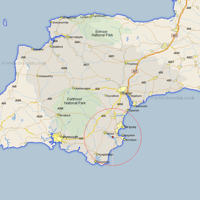
Devon Map Showing Location of Stoke Gabriel
Population: 1205
District: South Hams
Easting: 285115 Northing: 56885
Latitude: 50.4 Longitude: -3.62
 = Stoke Gabriel
District: South Hams
Easting: 285115 Northing: 56885
Latitude: 50.4 Longitude: -3.62
= Stoke Gabriel
This Stoke Gabriel map below is supplied by Google. Use the tools in the top left corner to zoom into street level or zoom out for a road map, you may also need to zoom in to see Stoke Gabriel on the map. Click and drag the map to move around. If the map fails to load try and refresh your browser or zoom in or out (+ or -).
Update - it seems Google no longer allow people to use their maps for free! This Stoke Gabriel map sometimes loads and sometimes gives a error. I am working on a solution.
Closest 30 Towns or Cities to Stoke Gabriel (Population over 500)
Stoke Gabriel 0km Berry Pomeroy 4.39km Totnes 5.89km Dartmouth 6.04km Blackawton 6.59km Kingswear 6.59km Paignton 7.24km Harberton 7.32km Marldon 7.51km Brixham 8.48km Strete 9.34km Street 9.34km Stoke Fleming 9.34km Ipplepen 9.34km Staverton 9.48km Torquay 10.37km Broadhempston 10.4km Abbotskerswell 11.12km Denbury 11.37km Kingskerswell 11.37km Diptford 11.81km East Allington 12.42km Stokeinteignhead 14.26km Newton Abbot 14.87km Buckfastleigh 15km Loddiswell 15.02km Stokenham 15.24km South Brent 15.79km Brent 15.79km Ashburton 16.05km