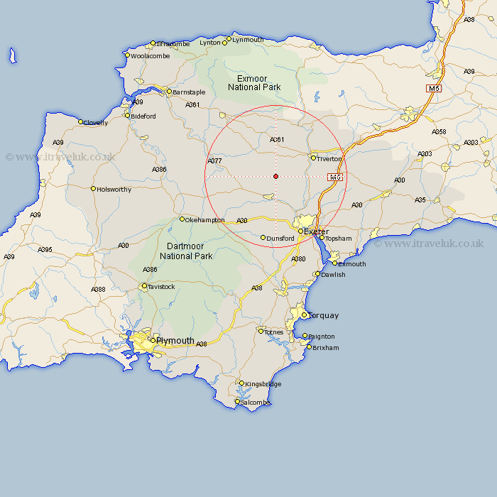
Devon Map Showing Location of Stockleigh English
Population: 63
District: Mid Devon
Easting: 285034 Northing: 106942
Latitude: 50.85 Longitude: -3.63
 = Stockleigh English
District: Mid Devon
Easting: 285034 Northing: 106942
Latitude: 50.85 Longitude: -3.63
= Stockleigh English
This Stockleigh English map below is supplied by Google. Use the tools in the top left corner to zoom into street level or zoom out for a road map, you may also need to zoom in to see Stockleigh English on the map. Click and drag the map to move around. If the map fails to load try and refresh your browser or zoom in or out (+ or -).
Update - it seems Google no longer allow people to use their maps for free! This Stockleigh English map sometimes loads and sometimes gives a error. I am working on a solution.
Closest 30 Towns or Cities to Stockleigh English (Population over 500)
Cheriton Fitzpaine 1.17km Sandford 4.38km Crediton 7.5km Morchard Bishop 8.19km Thorverton 8.96km Witheridge 9.44km Newton Saint Cyres 9.55km St Cyres 9.55km St. Cyres 9.55km Saint Cyres 9.55km Newton St Cyres 9.55km Newton St. Cyres 9.55km Copplestone 9.9km Silverton 11.17km Lapford 11.84km Tiverton 11.9km Stoke Canon 13.18km Whitestone 13.19km Tedburn Saint Mary 13.44km Tedburn St Mary 13.44km Tedburn St. Mary 13.44km Bow 14.03km Nymet Tracey 14.03km Cheriton Bishop 14.76km Holcombe Burnell 14.82km Chawleigh 15.09km Bradninch 15.33km Halberton 16.19km Cullompton 16.48km Broad Clyst 16.83km