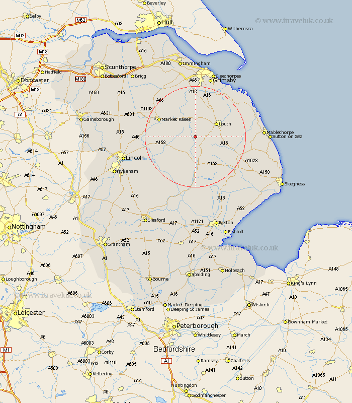
Lincolnshire Map Showing Location of Stenigot
Population: 43
District: East Lindsey
Easting: 524335 Northing: 381628
Latitude: 53.32 Longitude: -0.13
 = Stenigot
District: East Lindsey
Easting: 524335 Northing: 381628
Latitude: 53.32 Longitude: -0.13
= Stenigot
This Stenigot map below is supplied by Google. Use the tools in the top left corner to zoom into street level or zoom out for a road map, you may also need to zoom in to see Stenigot on the map. Click and drag the map to move around. If the map fails to load try and refresh your browser or zoom in or out (+ or -).
Update - it seems Google no longer allow people to use their maps for free! This Stenigot map sometimes loads and sometimes gives a error. I am working on a solution.
Closest 30 Towns or Cities to Stenigot (Population over 500)
Louth 9.53km Wragby 11.68km Legbourne 12.31km Banovallum 13.02km Horncastle 13.02km binbrook 13.38km Holton 13.42km Market Rasen 15.2km Grimoldby 15.42km Mareham 15.48km Mareham-on-the-Hill 15.48km Mareham on the Hill 15.48km Manby 16.46km Bardney 16.5km Fulstow 16.72km Middle Rasen 17.17km North Thoresby 17.57km Woodhall Spa 19.35km North Coates 20.01km Tetney 20.08km Scothern 21.37km Spilsby 21.47km Cherry Willingham 21.55km Sudbrooke 21.77km Reepham 22km Fiskerton 22km Grainthorpe 22.01km Nettleton 22.16km Caistor 22.16km Dunholm 22.22km