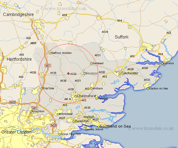
Essex Map Showing Location of Stebbing
Population: 1290
District: Uttlesford
Easting: 566308 Northing: 223335
Latitude: 51.88 Longitude: 0.42
 = Stebbing
District: Uttlesford
Easting: 566308 Northing: 223335
Latitude: 51.88 Longitude: 0.42
= Stebbing
This Stebbing map below is supplied by Google. Use the tools in the top left corner to zoom into street level or zoom out for a road map, you may also need to zoom in to see Stebbing on the map. Click and drag the map to move around. If the map fails to load try and refresh your browser or zoom in or out (+ or -).
Update - it seems Google no longer allow people to use their maps for free! This Stebbing map sometimes loads and sometimes gives a error. I am working on a solution.
Closest 30 Towns or Cities to Stebbing (Population over 500)
Dunmow 3.43km Great Dunmow 3.43km Felsted 3.88km Barnston 3.88km Great Easton 6.01km Panfield 6.86km Great Bardfield 7.2km Shalford 7.97km Thaxted 8.17km Wethersfield 8.71km Broxted 8.82km Finchingfield 9.55km Black Notley 9.88km Great Leighs 10.1km Braintree 10.3km High Easter 10.33km Little Waltham 10.33km Takeley 10.46km Great Sampford 11.18km Great Waltham 11.35km Rayne 11.59km Henham 12.71km Gosfield 12.71km Hatfield Broad Oak 12.72km Terling 13.03km Elsenham 13.12km Cressing 13.12km Broomfield 13.41km Stisted 13.73km Debden 13.85km