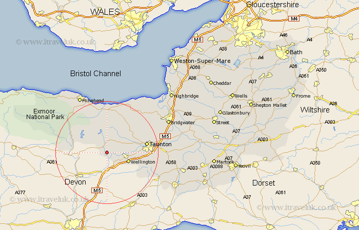
Somerset Map Showing Location of Stawley
Population: 244
District: Taunton Deane
Easting: 306451 Northing: 123196
Latitude: 51 Longitude: -3.33
 = Stawley
District: Taunton Deane
Easting: 306451 Northing: 123196
Latitude: 51 Longitude: -3.33
= Stawley
This Stawley map below is supplied by Google. Use the tools in the top left corner to zoom into street level or zoom out for a road map, you may also need to zoom in to see Stawley on the map. Click and drag the map to move around. If the map fails to load try and refresh your browser or zoom in or out (+ or -).
Update - it seems Google no longer allow people to use their maps for free! This Stawley map sometimes loads and sometimes gives a error. I am working on a solution.
Closest 30 Towns or Cities to Stawley (Population over 500)
Wiveliscombe 3.88km Milverton 6.12km Wellington 8.97km Oake 9.51km West Buckland 11.13km Bishops Lydeard 12.85km Norton Fitzwarren 13.35km Brushford 14.12km Stogumber 15km Williton 15km Trull 15.16km Dulverton 15.6km Taunton 15.6km Pitminster 15.61km Kingston 16.87km Watchet 18.54km Spaxton 19.94km Nether Stowey 20.34km West Monkton 20.58km Carhampton 21.2km Creech Saint Michael 22.23km Creech St Michael 22.23km Creech St. Michael 22.23km Hatch Beauchamp 23.4km Durleigh 23.67km Minehead 24.58km Stokscourey 24.71km Stogursey 24.71km Stoke Courcy 24.71km North Petherton 24.77km