Norfolk Map Showing Location of Stanhoe
Population: 196
District: King's Lynn and West Norfolk
Easting: 580459 Northing: 337024
Latitude: 52.9 Longitude: 0.68
 = Stanhoe
District: King's Lynn and West Norfolk
Easting: 580459 Northing: 337024
Latitude: 52.9 Longitude: 0.68
= Stanhoe
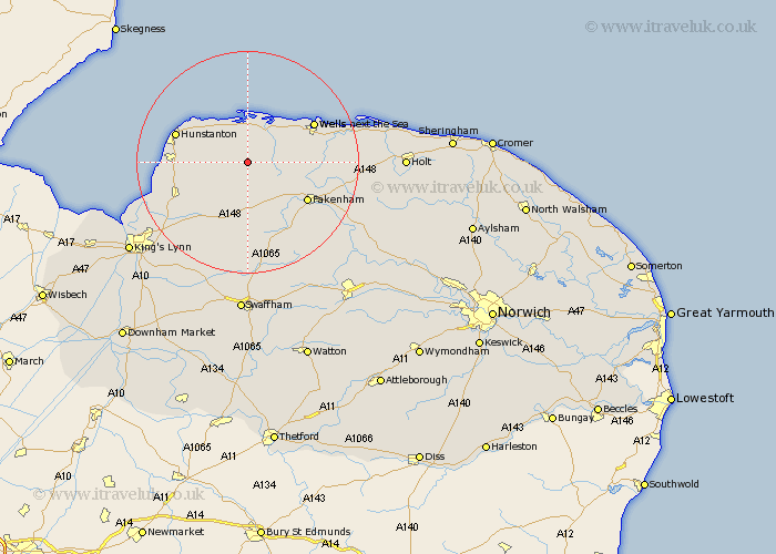
This Stanhoe map below is supplied by Google. Use the tools in the top left corner to zoom into street level or zoom out for a road map, you may also need to zoom in to see Stanhoe on the map. Click and drag the map to move around. If the map fails to load try and refresh your browser or zoom in or out (+ or -).
Update - it seems Google no longer allow people to use their maps for free! This Stanhoe map sometimes loads and sometimes gives a error. I am working on a solution.
Closest 30 Towns or Cities to Stanhoe (Population over 500)
Docking 4.47km South Creake 5.89km Syderstone 5.99km Burnham Market 6.49km Bircham 6.49km Great Bircham 6.49km Brancaster 7.75km Tattersett 8.14km Tatterset 8.14km Sedgeford 8.94km East Rudham 9.53km Sculthorpe 10.54km Ingoldesthorpe 11.78km Ingoldisthorpe 11.78km Fakenham 12.51km Snettisham 12.85km Wells-next-the-Sea 13.41km Wells on Sea 13.41km Wells 13.41km Wells-on-Sea 13.41km Wells next the Sea 13.41km Hunstanton 13.49km Dersingham 13.5km Heacham 13.54km Little Walsingham 13.55km Walsingham 13.55km Great Massingham 14.86km Massingham 14.86km Little Snoring 15.57km Colkirk 15.78km