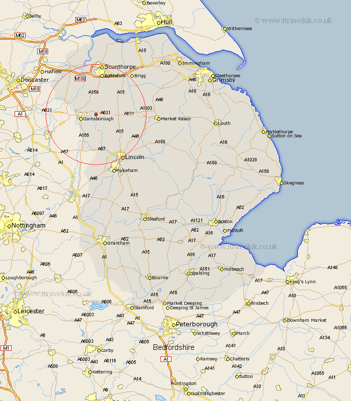
Lincolnshire Map Showing Location of Springthorpe
Population: 149
District: West Lindsey
Easting: 487532 Northing: 390078
Latitude: 53.4 Longitude: -0.68
 = Springthorpe
District: West Lindsey
Easting: 487532 Northing: 390078
Latitude: 53.4 Longitude: -0.68
= Springthorpe
This Springthorpe map below is supplied by Google. Use the tools in the top left corner to zoom into street level or zoom out for a road map, you may also need to zoom in to see Springthorpe on the map. Click and drag the map to move around. If the map fails to load try and refresh your browser or zoom in or out (+ or -).
Update - it seems Google no longer allow people to use their maps for free! This Springthorpe map sometimes loads and sometimes gives a error. I am working on a solution.
Closest 30 Towns or Cities to Springthorpe (Population over 500)
Blyton 4.31km Willingham 5.56km Lea 5.77km Gainesborough 5.83km Gainsborough 5.83km Morton 6.63km Scotton 7.74km Kirton 9.25km Kirton in Lindsey 9.25km Scotter 9.33km Marton 9.84km Ingham 9.95km Owston 10.78km Owston Ferry 10.78km Waddingham 12.36km Torksey 13.39km Scampton 13.55km Scrampton 13.55km Haxey 13.58km Hibaldstow 14.91km Messingham 14.99km Saxilby 14.99km Epworth 15.69km Bottesford 16.82km West Butterwick 17.25km Welton 17.32km Scawby 17.84km South Kelsey 18.15km Dunholm 18.18km Dunholme 18.18km