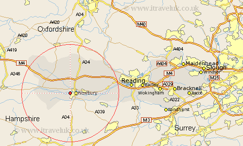
Berkshire Map Showing Location of Speen
Population: 2634
Easting: 445212 Northing: 167029
Latitude: 51.4 Longitude: -1.35
 = Speen
Easting: 445212 Northing: 167029
Latitude: 51.4 Longitude: -1.35
= Speen
This Speen map below is supplied by Google. Use the tools in the top left corner to zoom into street level or zoom out for a road map, you may also need to zoom in to see Speen on the map. Click and drag the map to move around. If the map fails to load try and refresh your browser or zoom in or out (+ or -).
Update - it seems Google no longer allow people to use their maps for free! This Speen map sometimes loads and sometimes gives a error. I am working on a solution.
Closest 30 Towns or Cities to Speen (Population over 500)
Newbury 2.31km Shaw 3.47km Greenham 4.98km Thatcham 5.78km Chieveley 6.02km Kintbury 6.07km Welford 6.55km Cold Ash 7.18km Hermitage 8.02km Inkpen 9.97km West Shefford 10.15km Shefford 10.15km Great Shefford 10.15km Bucklebury 11.04km Hungerford 11.71km Brimpton 12.14km East Garston 13.08km Beenham 14km Aldermaston 14km Compton 14.71km Bradfield 15.47km East Ilsley 15.53km Lambourn 18.16km Streatley 18.98km Basildon 19.62km Theale 19.99km Pangbourne 20.67km Burghfield 21.97km Tilehurst 22.65km Stratfield Mortimer 23.43km