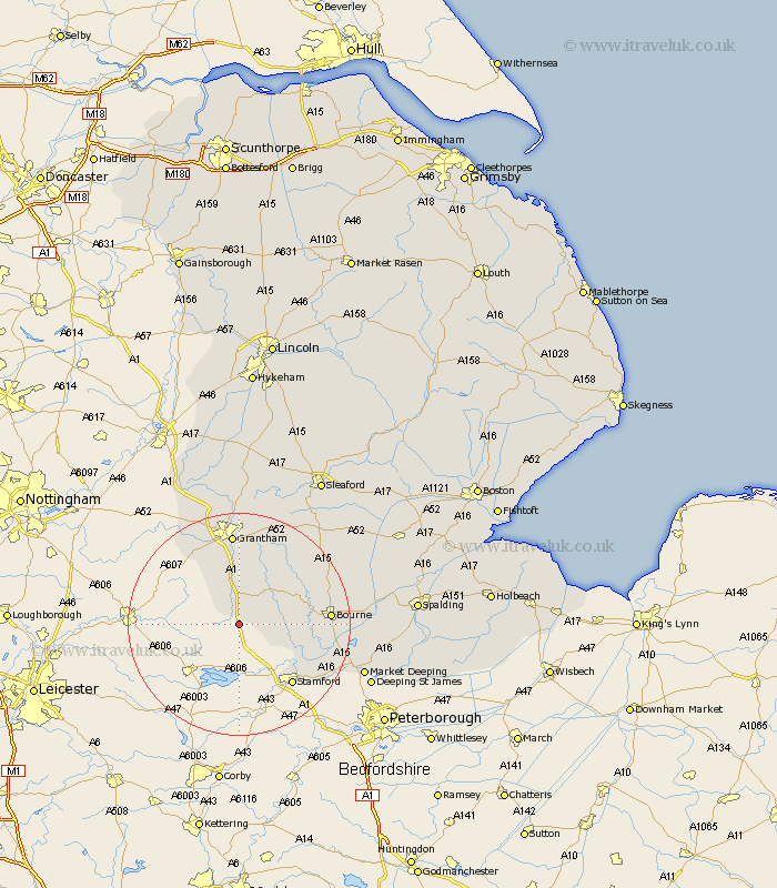
Lincolnshire Map Showing Location of South Witham
Population: 1439
District: South Kesteven
Easting: 493359 Northing: 317866
Latitude: 52.75 Longitude: -0.62
 = South Witham
District: South Kesteven
Easting: 493359 Northing: 317866
Latitude: 52.75 Longitude: -0.62
= South Witham
This South Witham map below is supplied by Google. Use the tools in the top left corner to zoom into street level or zoom out for a road map, you may also need to zoom in to see South Witham on the map. Click and drag the map to move around. If the map fails to load try and refresh your browser or zoom in or out (+ or -).
Update - it seems Google no longer allow people to use their maps for free! This South Witham map sometimes loads and sometimes gives a error. I am working on a solution.
Closest 30 Towns or Cities to South Witham (Population over 500)
Colsterworth 5.56km Castle Bytham 5.91km Corby 8.73km Harlaxton 13.73km Stamford 14.3km Bourne 15.81km Bourn 15.81km Ropsley 16.27km Grantham 16.72km Morton 17.22km Thurlby 17.24km Barrowby 17.27km Uffington 17.47km Rippingale 18.38km Baston 18.8km Great Gonerby 18.84km Folkingham 19.51km Langtoft 19.88km Langfoft 19.88km Belton 20.41km Allington 21.46km Pointon 22.06km Market Deeping 23.26km Billingborough 24.13km Ancaster 24.74km Deeping St James 25.06km Deeping Saint James 25.06km Deeping St. James 25.06km Long Bennington 25.7km Deeping St. Nicholas 28.3km