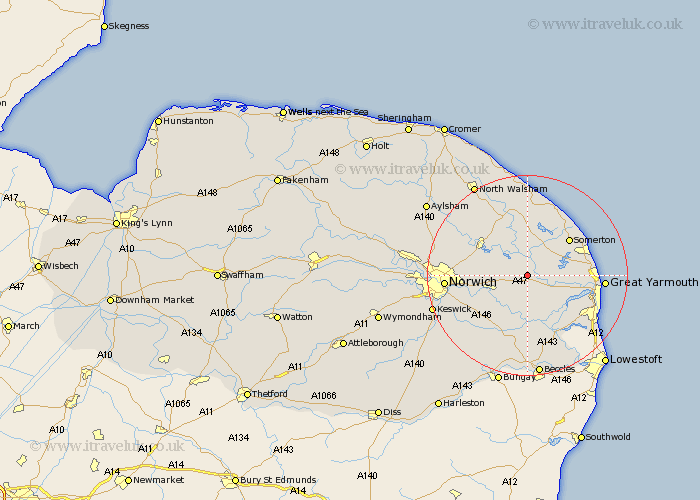
Norfolk Map Showing Location of South Walsham
Population: 738
District: Broadland
Easting: 638973 Northing: 311707
Latitude: 52.65 Longitude: 1.53
 = South Walsham
District: Broadland
Easting: 638973 Northing: 311707
Latitude: 52.65 Longitude: 1.53
= South Walsham
This South Walsham map below is supplied by Google. Use the tools in the top left corner to zoom into street level or zoom out for a road map, you may also need to zoom in to see South Walsham on the map. Click and drag the map to move around. If the map fails to load try and refresh your browser or zoom in or out (+ or -).
Update - it seems Google no longer allow people to use their maps for free! This South Walsham map sometimes loads and sometimes gives a error. I am working on a solution.
Closest 30 Towns or Cities to South Walsham (Population over 500)
Upton 1.12km Acle 2.17km Lingwood 5.01km Ludham 5.56km Horning 6km Blofield 6.73km Freethorpe 7.5km Brundall 7.7km Potter Heigham 7.75km Martham 7.9km Salhouse 8.7km Great Plumstead 8.99km Filby 8.99km Catfield 9.26km Cantley 9.33km Rollesby 9.72km Neatishead 10.29km Hoveton 10.39km Wroxham 10.57km Beeston Saint Lawrence 10.83km Beeston St Lawrence 10.83km Beeston 10.83km Beeston St. Lawrence 10.83km Sutton 11.12km Reedham 11.35km Ormesby St. Margaret 11.39km Great Ormesby 11.39km Ormesby Saint Margaret 11.39km Ormesby St Margaret 11.39km Hickling 11.62km