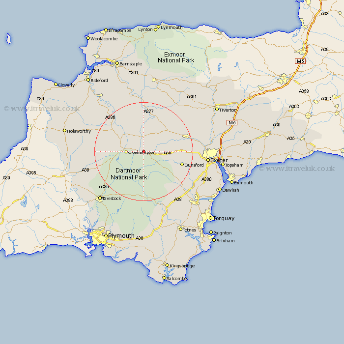
Devon Map Showing Location of South Tawton
Population: 1231
District: West Devon
Easting: 265932 Northing: 94416
Latitude: 50.73 Longitude: -3.9
 = South Tawton
District: West Devon
Easting: 265932 Northing: 94416
Latitude: 50.73 Longitude: -3.9
= South Tawton
This South Tawton map below is supplied by Google. Use the tools in the top left corner to zoom into street level or zoom out for a road map, you may also need to zoom in to see South Tawton on the map. Click and drag the map to move around. If the map fails to load try and refresh your browser or zoom in or out (+ or -).
Update - it seems Google no longer allow people to use their maps for free! This South Tawton map sometimes loads and sometimes gives a error. I am working on a solution.
Closest 30 Towns or Cities to South Tawton (Population over 500)
Sampford Courtney 6.58km Sampford Courtenay 6.58km Sampford Courtnay 6.58km Okehampton 7.04km Chagford 7.28km North Tawton 7.42km Drewsteignton 9.01km Nymet Tracey 9.45km Bow 9.45km Cheriton Bishop 11.73km Copplestone 12.9km Moretonhampstead 14.05km Hatherleigh 14.94km Bridestowe 15.14km Tedburn St Mary 15.25km Tedburn Saint Mary 15.25km Tedburn St. Mary 15.25km Northlew 15.69km Dunsford 16.24km Lapford 16.41km Morchard Bishop 16.72km Dartmoor Forest 16.72km Lustleigh 18.3km Crediton 18.44km Sandford 18.85km Holcombe Burnell 18.86km Chawleigh 19.12km Dolton 19.13km Widdecombe 19.82km Widecombe in the Moor 19.82km