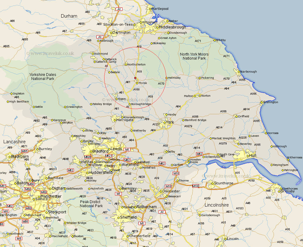
Yorkshire Map Showing Location of South Kilvington
Population: 231
District: Hambleton
Easting: 442347 Northing: 484025
Latitude: 54.25 Longitude: -1.35
 = South Kilvington
District: Hambleton
Easting: 442347 Northing: 484025
Latitude: 54.25 Longitude: -1.35
= South Kilvington
This South Kilvington map below is supplied by Google. Use the tools in the top left corner to zoom into street level or zoom out for a road map, you may also need to zoom in to see South Kilvington on the map. Click and drag the map to move around. If the map fails to load try and refresh your browser or zoom in or out (+ or -).
Update - it seems Google no longer allow people to use their maps for free! This South Kilvington map sometimes loads and sometimes gives a error. I am working on a solution.
Closest 30 Towns or Cities to South Kilvington (Population over 500)
Thirsk 3.86km Topcliffe 7.73km Northallerton 10.73km Brompton 11.93km Dishforth 11.94km Osmotherley 13.38km Raskelf 14.52km Tanfield 15.14km West Tanfield 15.14km Bedale 15.6km Ampleforth 16.15km Easingwold 17.75km Crakehall 18.19km Ripon 18.37km Helmsley 18.41km Boroughbridge 18.82km Whorlton 19.64km Masham 19.85km Alne 20.03km Marton 20.41km Marton le Moor 20.41km Grewelthorpe 20.87km Bishop Monkton 20.95km Monkton 20.95km North Cowton 21.13km Kirkby Malzeard 21.6km Scorton 21.97km Cowton 22.02km East Cowton 22.02km Tollerton 22.15km