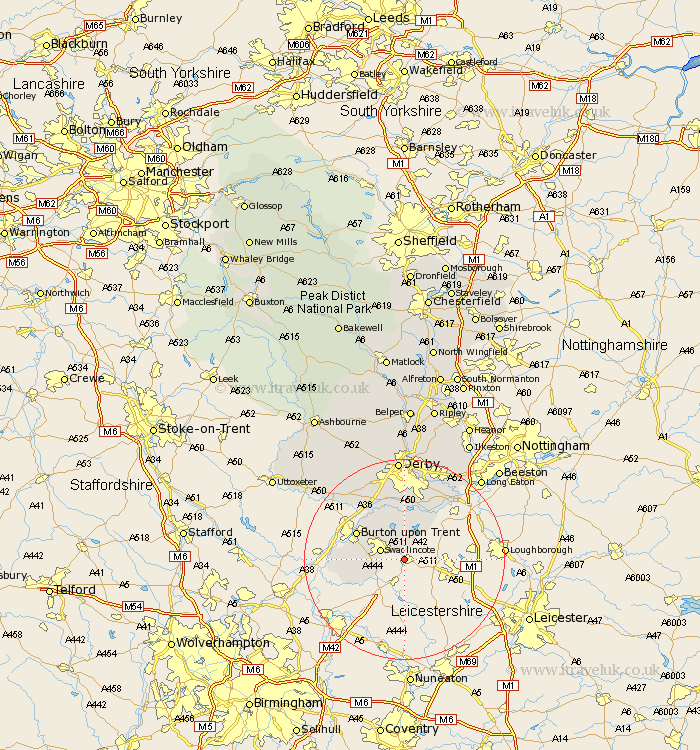
Derbyshire Map Showing Location of Smisby
Population: 264
District: South Derbyshire
Easting: 434870 Northing: 317094
Latitude: 52.75 Longitude: -1.48
 = Smisby
District: South Derbyshire
Easting: 434870 Northing: 317094
Latitude: 52.75 Longitude: -1.48
= Smisby
This Smisby map below is supplied by Google. Use the tools in the top left corner to zoom into street level or zoom out for a road map, you may also need to zoom in to see Smisby on the map. Click and drag the map to move around. If the map fails to load try and refresh your browser or zoom in or out (+ or -).
Update - it seems Google no longer allow people to use their maps for free! This Smisby map sometimes loads and sometimes gives a error. I am working on a solution.
Closest 30 Towns or Cities to Smisby (Population over 500)
Woodville 2.24km Hartshorne 2.91km Hartshorn 2.91km Swadlincote 4.86km Ticknall 5.56km Gresley 5.61km Church Gresley 5.61km Overseal 6.72km Linton 6.98km Bretby 7.68km Melbourne 8.14km Newton Solney 10.01km Rosliston 10.27km Repton 10.29km Willington 10.29km Burton upon Trent 10.55km Burton on Trent 10.55km Burton-on-Trent 10.55km Coton in the Elms 10.76km Weston-on-Trent 10.83km Weston on Trent 10.83km Weston upon Trent 10.83km Findern 11.62km Egginton 12.14km Walton on Trent 13.46km Walton-on-Trent 13.46km Walton 13.46km Walton upon Trent 13.46km Shardlow 14.28km Etwall 15.16km