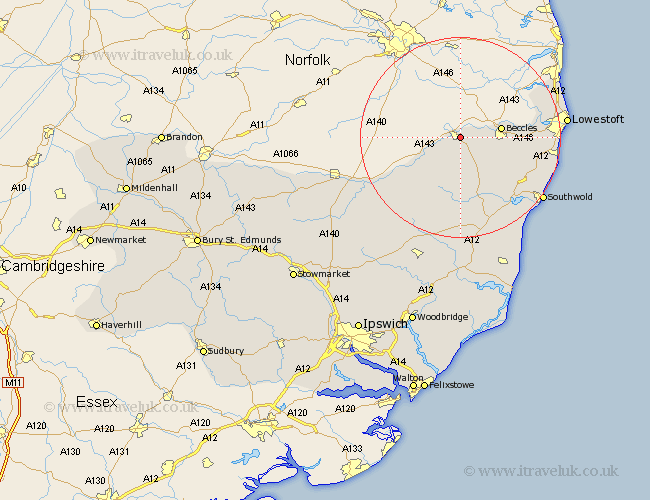
Suffolk Map Showing Location of Bungay
Population: 3333
Area Size (ha): 165
District: Waveney
Easting: 634403 Northing: 289199
Latitude: 52.45 Longitude: 1.45
 = Bungay
Area Size (ha): 165
District: Waveney
Easting: 634403 Northing: 289199
Latitude: 52.45 Longitude: 1.45
= Bungay
This Bungay map below is supplied by Google. Use the tools in the top left corner to zoom into street level or zoom out for a road map, you may also need to zoom in to see Bungay on the map. Click and drag the map to move around. If the map fails to load try and refresh your browser or zoom in or out (+ or -).
Update - it seems Google no longer allow people to use their maps for free! This Bungay map sometimes loads and sometimes gives a error. I am working on a solution.
Closest 30 Towns or Cities to Bungay (Population over 500)
Beccles 8.12km Worlingham 9.04km Halesworth 11.62km Holton 13.74km Cookley 14.82km Fressingfield 15.07km Wangford 15.86km Wenhaston 16.3km Carlton Colville 16.94km Wrentham 17.48km Laxfield 17.61km Gisleham 18.17km Reydon 18.43km Kessingland 18.45km Stradbroke 19.35km Oulton 19.55km Hoxne 20.28km Southwold 20.47km Lowestoft 20.66km Yoxford 20.88km Corton 22.69km Dennington 22.79km Worlingworth 24.49km Eye 25.18km Saxmundham 26.16km Framlingham 27.13km Thorndon 28.39km Leiston 28.91km Wortham 29.33km Snape 29.85km