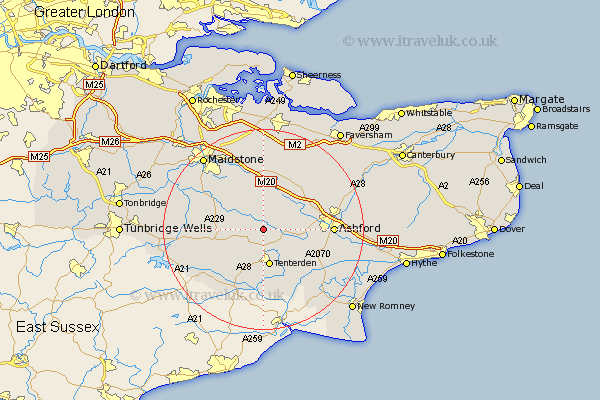
Kent Map Showing Location of Smarden
Population: 1222
District: Ashford
Easting: 587715 Northing: 140596
Latitude: 51.13 Longitude: 0.68
 = Smarden
District: Ashford
Easting: 587715 Northing: 140596
Latitude: 51.13 Longitude: 0.68
= Smarden
This Smarden map below is supplied by Google. Use the tools in the top left corner to zoom into street level or zoom out for a road map, you may also need to zoom in to see Smarden on the map. Click and drag the map to move around. If the map fails to load try and refresh your browser or zoom in or out (+ or -).
Update - it seems Google no longer allow people to use their maps for free! This Smarden map sometimes loads and sometimes gives a error. I am working on a solution.
Closest 30 Towns or Cities to Smarden (Population over 500)
Headcorn 5.01km Biddenden 5.09km High Halden 6.03km Bethersden 6.1km Egerton 6.56km Frittenden 6.98km Pluckley 7.25km Tenterden 7.57km Ulcombe 7.77km Woodchurch 9.42km Hothfield 9.49km Shadoxhurst 10.02km Sutton Valence 10.18km Staplehurst 10.63km Charing 11.01km Harrietsham 11.12km Lenham 11.36km Benenden 11.6km Beneden 11.6km Rolvenden 11.66km Cranbrook 11.86km Leeds 12.05km Kingsnorth 12.21km Langley 13.12km Hollingbourne 13.18km Marden 13.32km Orlestone 13.8km Ashford 13.96km Boughton Monchelsea 13.98km Kennington 14.08km