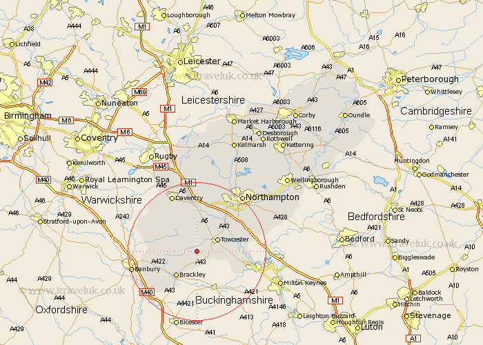
Northamptonshire Map Showing Location of Slapton
Population: 91
District: South Northamptonshire
Easting: 463923 Northing: 245085
Latitude: 52.1 Longitude: -1.07
 = Slapton
District: South Northamptonshire
Easting: 463923 Northing: 245085
Latitude: 52.1 Longitude: -1.07
= Slapton
This Slapton map below is supplied by Google. Use the tools in the top left corner to zoom into street level or zoom out for a road map, you may also need to zoom in to see Slapton on the map. Click and drag the map to move around. If the map fails to load try and refresh your browser or zoom in or out (+ or -).
Update - it seems Google no longer allow people to use their maps for free! This Slapton map sometimes loads and sometimes gives a error. I am working on a solution.
Closest 30 Towns or Cities to Slapton (Population over 500)
Syresham 3.87km Silverstone 3.89km Helmdon 4.92km Whittlebury 5.99km Towcester 6.79km Pattishall 8.17km Greatworth 8.79km Paulerspury 9.3km Brackley 9.35km Gayton 10.08km Bugbrooke 11.63km Blisworth 11.74km Weedon Beck 12.98km Weedon 12.98km Potterspury 13.06km Byfield 13.58km Roade 13.7km Chipping Warden 13.78km Milton 13.81km Kislingbury 14.66km Collingtree 14.67km Flore 14.87km Chalcombe 14.92km Chacombe 14.92km Badby 15.22km Hartwell 15.25km Wootton 15.57km Denshanger 15.82km Deanshanger 15.82km Croughton 15.86km