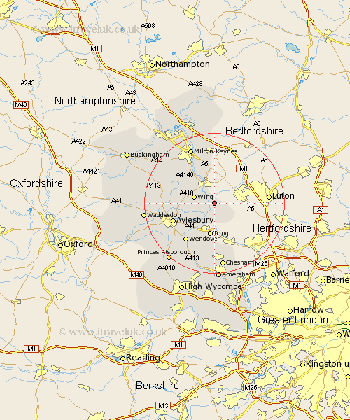
Buckinghamshire Map Showing Location of Slapton
Population: 590
District: Aylesbury Vale
Easting: 494089 Northing: 219611
Latitude: 51.87 Longitude: -0.63
 = Slapton
District: Aylesbury Vale
Easting: 494089 Northing: 219611
Latitude: 51.87 Longitude: -0.63
= Slapton
This Slapton map below is supplied by Google. Use the tools in the top left corner to zoom into street level or zoom out for a road map, you may also need to zoom in to see Slapton on the map. Click and drag the map to move around. If the map fails to load try and refresh your browser or zoom in or out (+ or -).
Update - it seems Google no longer allow people to use their maps for free! This Slapton map sometimes loads and sometimes gives a error. I am working on a solution.
Closest 30 Towns or Cities to Slapton (Population over 500)
Ivinghoe 3.89km Edlesborough 3.9km Cheddington 4.36km Pitstone 5.68km Wing 6.01km Marsworth 6.01km Soulbury 9.36km Buckland 9.37km Aston Clinton 9.37km Stewkley 9.75km Great Brickhill 9.88km Stoke Hammond 10.88km Halton 11.54km Weston Turville 12.26km Aylesbury 12.73km Bow Brickhill 13.17km Wendover 13.71km Whitchurch 13.85km Whitechurch 13.85km Stoke Mandeville 13.87km Newton Longville 14.4km Mursley 14.6km Bletchley 14.67km Woburn Sands 14.82km North Marston 16.12km Ellesborough 16.57km Stone 16.63km Wavendon 16.84km Lee 17.03km Milton Keynes 17.29km