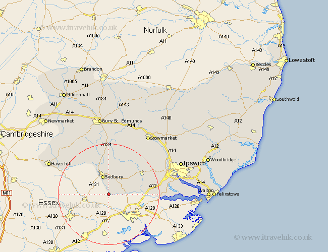
Suffolk Map Showing Location of Bures
District: Babergh
Easting: 590038 Northing: 233465
Latitude: 51.97 Longitude: 0.77
 = Bures
Easting: 590038 Northing: 233465
Latitude: 51.97 Longitude: 0.77
= Bures
This Bures map below is supplied by Google. Use the tools in the top left corner to zoom into street level or zoom out for a road map, you may also need to zoom in to see Bures on the map. Click and drag the map to move around. If the map fails to load try and refresh your browser or zoom in or out (+ or -).
Update - it seems Google no longer allow people to use their maps for free! This Bures map sometimes loads and sometimes gives a error. I am working on a solution.
Closest 30 Towns or Cities to Bures (Population over 500)
Great Cornard 7.41km Sudbury 7.75km Boxford 8.82km Polstead 9.85km Great Waldingfield 11.18km Waldingfield 11.18km Long Melford 11.63km Layham 14.78km Lavenham 15km Hadleigh 15.6km Cavendish 15.85km Glemsford 16.32km East Bergholt 17.13km Bildeston 18.03km Clare 18.04km Hitcham 19.01km Cockfield 20.41km Lawshall 20.51km Manningtree 20.64km Capel Saint Mary 20.88km Capel St Mary 20.88km Capel 20.88km Capel St. Mary 20.88km Hundon 20.96km Hintlesham 21.49km Bentley 21.77km Great Bricett 22.31km Kedington 23.32km Ringshall 23.72km Somersham 24.4km