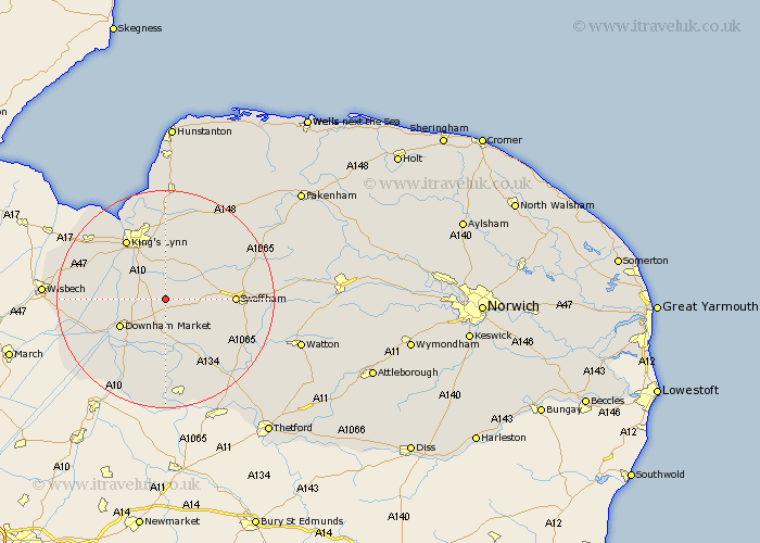
Norfolk Map Showing Location of Shouldham
Population: 608
District: King's Lynn and West Norfolk
Easting: 567971 Northing: 308740
Latitude: 52.65 Longitude: 0.48
 = Shouldham
District: King's Lynn and West Norfolk
Easting: 567971 Northing: 308740
Latitude: 52.65 Longitude: 0.48
= Shouldham
This Shouldham map below is supplied by Google. Use the tools in the top left corner to zoom into street level or zoom out for a road map, you may also need to zoom in to see Shouldham on the map. Click and drag the map to move around. If the map fails to load try and refresh your browser or zoom in or out (+ or -).
Update - it seems Google no longer allow people to use their maps for free! This Shouldham map sometimes loads and sometimes gives a error. I am working on a solution.
Closest 30 Towns or Cities to Shouldham (Population over 500)
Marham 4.5km Runcton Holme 5.62km Runcton 5.62km North Runcton 6.5km Watlington 7km Wereham 7.42km Middleton 7.5km Narborough 7.69km East Winch 9.33km Stoke Ferry 9.53km Downham Market 9.64km Gayton 10.3km Denver 10.82km Swaffham 12.37km Hilgay 12.46km Lynn 13km Lynn Regis 13km Kings Lynn 13km King's Lynn 13km South Wootton 13.41km Tilney St. Lawrence 13.55km Tilney 13.55km Tilney St Lawrence 13.55km Tilney Saint Lawrence 13.55km Northwold 13.63km Grimston 13.73km Clenchwarton 14.3km Castle Acre 14.59km North Wootton 15.2km Methwold 15.49km