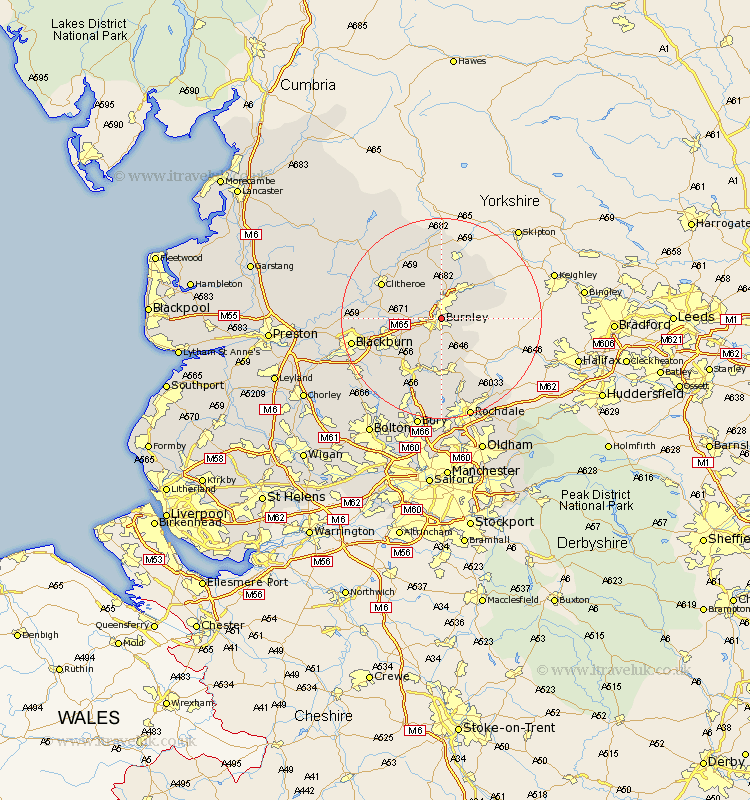
Lancashire Map Showing Location of Burnley
Population: 73396
Area Size (ha): 1554
District: Burnley
Easting: 384633 Northing: 433793
Latitude: 53.8 Longitude: -2.23
 = Burnley
Area Size (ha): 1554
District: Burnley
Easting: 384633 Northing: 433793
Latitude: 53.8 Longitude: -2.23
= Burnley
This Burnley map below is supplied by Google. Use the tools in the top left corner to zoom into street level or zoom out for a road map, you may also need to zoom in to see Burnley on the map. Click and drag the map to move around. If the map fails to load try and refresh your browser or zoom in or out (+ or -).
Update - it seems Google no longer allow people to use their maps for free! This Burnley map sometimes loads and sometimes gives a error. I am working on a solution.
Closest 30 Towns or Cities to Burnley (Population over 500)
Brierfield 1.86km Nelson 4.3km Barrowford 5.67km Hapton 5.78km Padiham 5.78km Sabden 6.82km Altham 6.82km Colne 7.07km Simonstone 7.89km Accrington 8.51km Foulridge 8.61km Laneshaw Bridge 9.46km Clayton le Moors 10.53km Clayton-le-Moors 10.53km Clayton le Moor 10.53km Kelbrook 10.76km Church 11.32km Rawtenstall 11.6km Bacup 11.6km Salterforth 11.95km Chatburn 12.02km Whalley 12.18km Great Harwood 12.19km Haslingden 12.92km Clitheroe 13.21km Oswaldtwistle 13.23km Rishton 13.27km Barnoldswick 13.38km Grindleton 14.15km Langho 14.23km