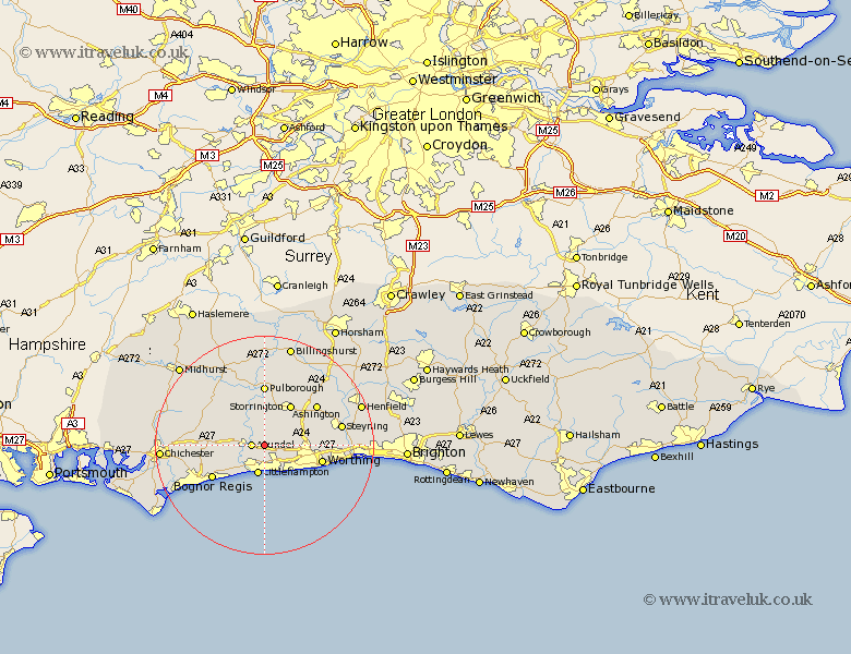
Sussex Map Showing Location of Burpham
Population: 193
District: Arun
Easting: 504407 Northing: 106719
Latitude: 50.85 Longitude: -0.52
 = Burpham
District: Arun
Easting: 504407 Northing: 106719
Latitude: 50.85 Longitude: -0.52
= Burpham
This Burpham map below is supplied by Google. Use the tools in the top left corner to zoom into street level or zoom out for a road map, you may also need to zoom in to see Burpham on the map. Click and drag the map to move around. If the map fails to load try and refresh your browser or zoom in or out (+ or -).
Update - it seems Google no longer allow people to use their maps for free! This Burpham map sometimes loads and sometimes gives a error. I am working on a solution.
Closest 30 Towns or Cities to Burpham (Population over 500)
Arundel 2.34km Angmering 4.38km Littlehampton 5.68km Rustington 5.68km Ford 5.97km Bury 6.57km Walberton 7.02km West Ferring 7.27km Ferring 7.27km Amberley 7.51km Yapton 8.07km Slindon 8.19km Findon 8.19km East Preston 8.21km Preston 8.21km Kingston 8.77km Storrington 8.89km Barnham 8.99km Westergate 9.17km Coldwaltham 9.34km Eastergate 9.54km Washington 9.9km Middleton 10.22km Middleton-on-Sea 10.22km Middleton on Sea 10.22km West Chillington 10.38km West Chiltington 10.38km Worthing 11.05km Pulborough 11.12km Bognor Regis 11.29km