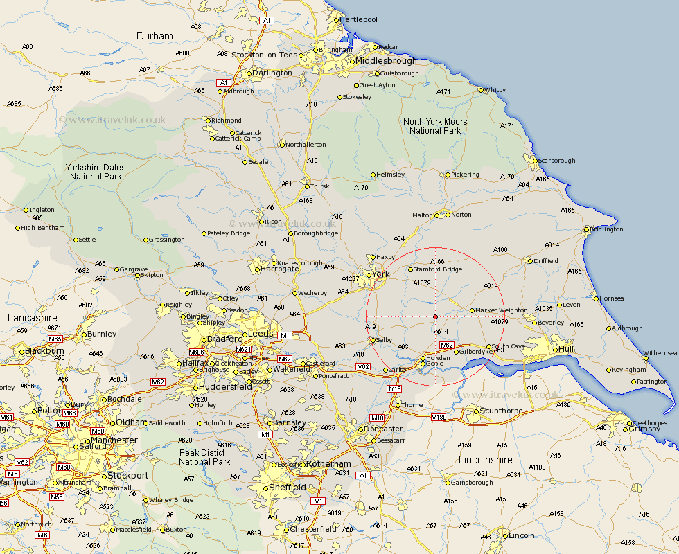
Yorkshire Map Showing Location of Seaton Ross
Population: 545
Easting: 477836 Northing: 439979
Latitude: 53.85 Longitude: -0.82
 = Seaton Ross
Easting: 477836 Northing: 439979
Latitude: 53.85 Longitude: -0.82
= Seaton Ross
This Seaton Ross map below is supplied by Google. Use the tools in the top left corner to zoom into street level or zoom out for a road map, you may also need to zoom in to see Seaton Ross on the map. Click and drag the map to move around. If the map fails to load try and refresh your browser or zoom in or out (+ or -).
Update - it seems Google no longer allow people to use their maps for free! This Seaton Ross map sometimes loads and sometimes gives a error. I am working on a solution.
Closest 30 Towns or Cities to Seaton Ross (Population over 500)
Holme upon Spalding Moor 3.77km Holme 3.77km Melbourne 4.3km Bubwith 7.54km Barmby 9.26km Barmby-on-the-Moor 9.26km Barmby on the Moor 9.26km Sutton upon Derwent 9.9km Sutton 9.9km Market Weighton 10.01km Pocklington 10.24km Wheldrake 10.51km Eastrington 11.33km Wilberfoss 11.95km Fangfoss 13.02km Howden 13.39km North Cave 14.34km Hemingbrough 14.34km Cliff Common Station 14.34km Cliffe Common 14.34km Hook 14.98km Goole 15.18km Riccall 15.42km Escrick 15.74km Airmyn 15.8km Stamford Bridge 16.2km Newport 16.39km South Cave 16.98km Barlow 17.21km Selby 18.01km