Norfolk Map Showing Location of Sculthorpe
Population: 744
District: North Norfolk
Easting: 589643 Northing: 331808
Latitude: 52.85 Longitude: 0.82
 = Sculthorpe
District: North Norfolk
Easting: 589643 Northing: 331808
Latitude: 52.85 Longitude: 0.82
= Sculthorpe
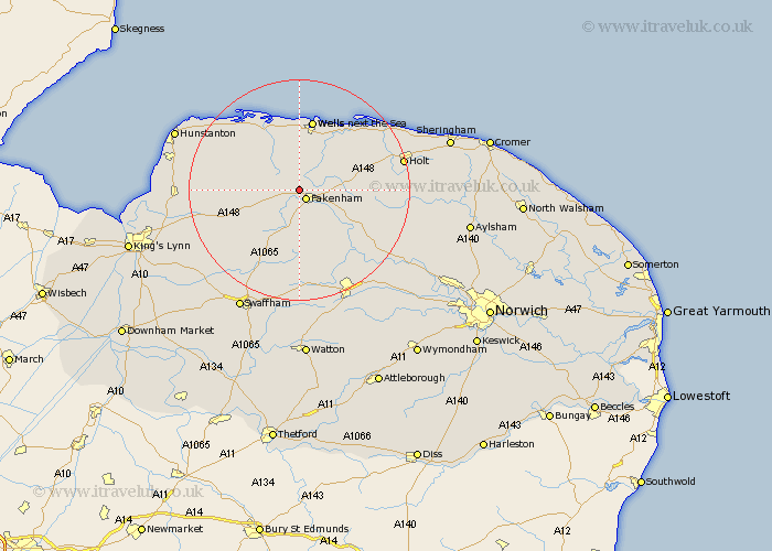
This Sculthorpe map below is supplied by Google. Use the tools in the top left corner to zoom into street level or zoom out for a road map, you may also need to zoom in to see Sculthorpe on the map. Click and drag the map to move around. If the map fails to load try and refresh your browser or zoom in or out (+ or -).
Update - it seems Google no longer allow people to use their maps for free! This Sculthorpe map sometimes loads and sometimes gives a error. I am working on a solution.
Closest 30 Towns or Cities to Sculthorpe (Population over 500)
Sculthorpe 0km Fakenham 2.17km South Creake 5km Little Snoring 5.6km Walsingham 5.81km Little Walsingham 5.81km Tattersett 5.9km Tatterset 5.9km Colkirk 5.99km Syderstone 6.72km Great Ryburgh 7.67km Ryburgh 7.67km East Rudham 7.67km Bircham 12.31km Great Bircham 12.31km Burnham Market 12.45km Wells-next-the-Sea 13.17km Wells-on-Sea 13.17km Wells on Sea 13.17km Wells next the Sea 13.17km Wells 13.17km Mileham 13.17km Great Massingham 13.69km Massingham 13.69km Hindolveston 13.94km Docking 14.53km Melton Constable 14.55km Mellon Constable 14.55km Litcham 14.86km Foulham 15.35km