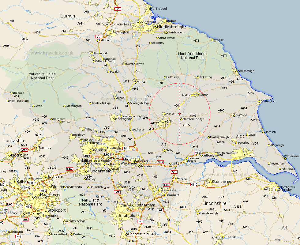
Yorkshire Map Showing Location of Sand Hutton
Population: 193
District: Ryedale
Easting: 469883 Northing: 458401
Latitude: 54.02 Longitude: -0.93
 = Sand Hutton
District: Ryedale
Easting: 469883 Northing: 458401
Latitude: 54.02 Longitude: -0.93
= Sand Hutton
This Sand Hutton map below is supplied by Google. Use the tools in the top left corner to zoom into street level or zoom out for a road map, you may also need to zoom in to see Sand Hutton on the map. Click and drag the map to move around. If the map fails to load try and refresh your browser or zoom in or out (+ or -).
Update - it seems Google no longer allow people to use their maps for free! This Sand Hutton map sometimes loads and sometimes gives a error. I am working on a solution.
Closest 30 Towns or Cities to Sand Hutton (Population over 500)
Stamford Bridge 3.87km Strensall 7.51km Earswick 7.85km Huntington 7.85km Wilberfoss 8.1km Fangfoss 8.58km Sheriff Hutton 8.59km Wigginton 8.71km Haxby 8.71km New Earswick 9.47km Heslington 9.89km Sutton upon Derwent 11.17km Sutton 11.17km York 11.27km Terrington 11.33km Barmby on the Moor 12.01km Barmby 12.01km Barmby-on-the-Moor 12.01km Clifton 12.23km Skelton 13.2km Shipton 14.27km Bishopthorne 14.31km Bishopthorpe 14.31km Slingsby 14.86km Wheldrake 14.99km Huby 15.01km Stillington 15.13km Pocklington 15.16km Upper Poppleton 15.22km Poppleton 15.22km