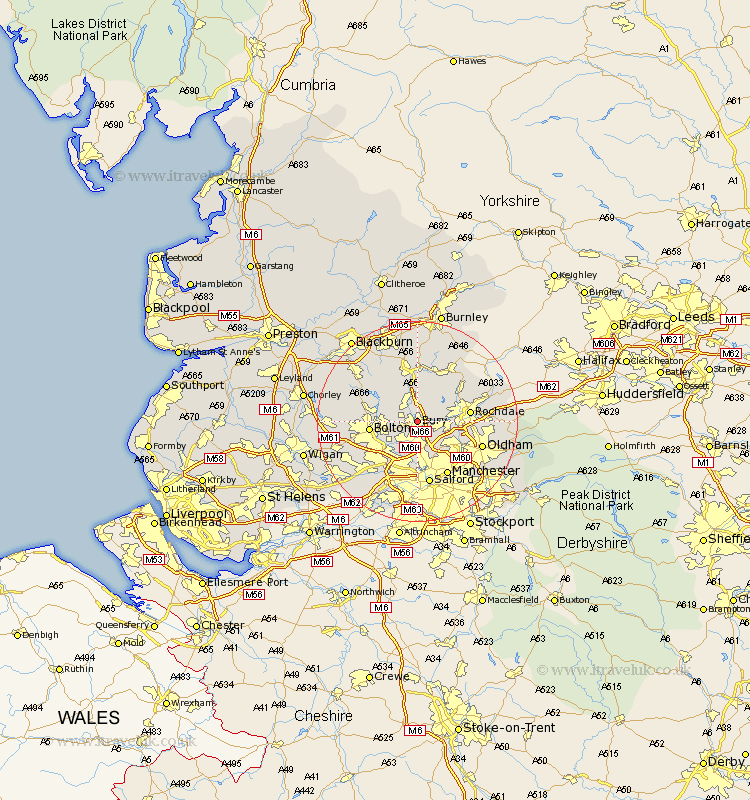
Lancashire Map Showing Location of Bury
Population: 61613
Area Size (ha): 1547
District: Bury
Easting: 380149 Northing: 411560
Latitude: 53.6 Longitude: -2.3
 = Bury
Area Size (ha): 1547
District: Bury
Easting: 380149 Northing: 411560
Latitude: 53.6 Longitude: -2.3
= Bury
This Bury map below is supplied by Google. Use the tools in the top left corner to zoom into street level or zoom out for a road map, you may also need to zoom in to see Bury on the map. Click and drag the map to move around. If the map fails to load try and refresh your browser or zoom in or out (+ or -).
Update - it seems Google no longer allow people to use their maps for free! This Bury map sometimes loads and sometimes gives a error. I am working on a solution.
Closest 30 Towns or Cities to Bury (Population over 500)
Tottington 2.2km Ramsbottom 3.86km Whitefield 5.56km Heywood 5.8km Radcliffe 5.98km Bromley Cross 6.6km Bradshaw 6.6km Little Lever 7.09km Edenfield 7.42km Prestwich 7.5km Turton 7.56km Middleton 8.63km Farnworth 8.63km Bolton 8.99km Kearsley 9.23km Whitworth 9.49km Pendlebury 9.52km Rochdale 10.07km Rawtenstall 11.17km Haslingden 11.33km Walkden 11.38km Swinton 11.6km Wardle 12.32km Manchester 12.41km Royton 12.65km Salford 13.16km Eccles 13.16km Milnrow 13.2km Oldham 13.32km Bacup 13.52km