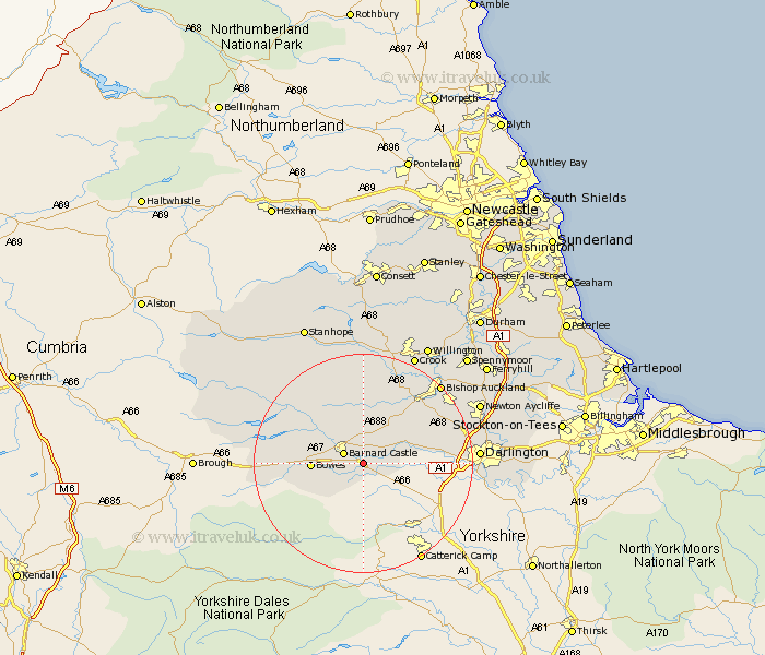
Durham Map Showing Location of Rokeby
Population: 71
District: Teesdale
Easting: 408630 Northing: 513511
Latitude: 54.52 Longitude: -1.87
 = Rokeby
District: Teesdale
Easting: 408630 Northing: 513511
Latitude: 54.52 Longitude: -1.87
= Rokeby
This Rokeby map below is supplied by Google. Use the tools in the top left corner to zoom into street level or zoom out for a road map, you may also need to zoom in to see Rokeby on the map. Click and drag the map to move around. If the map fails to load try and refresh your browser or zoom in or out (+ or -).
Update - it seems Google no longer allow people to use their maps for free! This Rokeby map sometimes loads and sometimes gives a error. I am working on a solution.
Closest 30 Towns or Cities to Rokeby (Population over 500)
Barnard Castle 3.72km Startforth 3.72km Staindrop 7.03km Cotherstone 9.36km Gainford 9.37km Cockfield 11.92km Evenwood 12.85km West Auckland 15.56km Etherley 16.62km High Etherley 16.62km Middleton in Teesdale 17.85km Shildon 19.06km Darlington 19.45km Bishop Auckland 19.64km Coundon 21.75km Crook 22.12km Wolsingham 22.27km Newton Aycliffe 22.31km Hurworth 22.9km Tow Law 24.3km Willington 24.69km Spennymoor 26.59km Ferryhill 27.56km Stanhope 27.68km Stillington 29.44km Cornsay 30.33km West Cornforth 30.39km Cornforth 30.39km Brandon 30.53km Bishop Middleham 30.87km