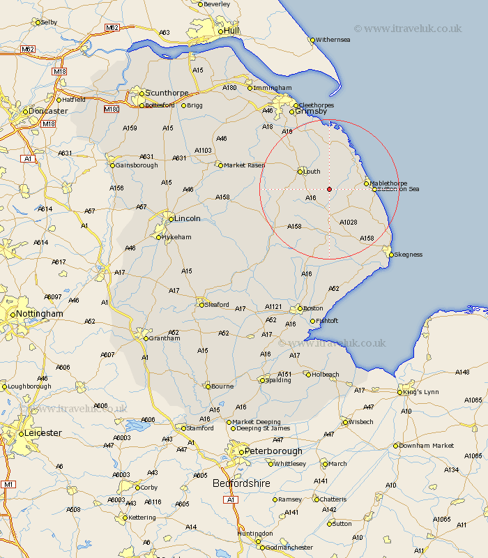
Lincolnshire Map Showing Location of Reston
Population: 218
District: East Lindsey
Easting: 539875 Northing: 382060
Latitude: 53.32 Longitude: 0.1
 = Reston
District: East Lindsey
Easting: 539875 Northing: 382060
Latitude: 53.32 Longitude: 0.1
= Reston
This Reston map below is supplied by Google. Use the tools in the top left corner to zoom into street level or zoom out for a road map, you may also need to zoom in to see Reston on the map. Click and drag the map to move around. If the map fails to load try and refresh your browser or zoom in or out (+ or -).
Update - it seems Google no longer allow people to use their maps for free! This Reston map sometimes loads and sometimes gives a error. I am working on a solution.
Closest 30 Towns or Cities to Reston (Population over 500)
Legbourne 3.8km Manby 5.56km Grimoldby 5.67km Alford 9.26km Louth 9.53km Mablethorpe 10.13km Saltfleetby St Clement 10.79km Saltfleetby St. Clement 10.79km Saltfleetby Saint Clement 10.79km Saltfleetby 10.79km Sutton-on-Sea 12.18km Sutton on Sea 12.18km Saltfleet 12.42km Willoughby 12.96km Huttoft 13.33km North Somercotes 13.38km Spilsby 14.83km Grainthorpe 16.72km Fulstow 16.72km North Coates 17.25km Chapel St Leonards 18.2km Chapel Saint Leonards 18.2km Chapel St. Leonards 18.2km Mareham 18.52km Mareham on the Hill 18.52km Mareham-on-the-Hill 18.52km Banovallum 19.39km Horncastle 19.39km North Thoresby 19.42km Tetney 20.07km