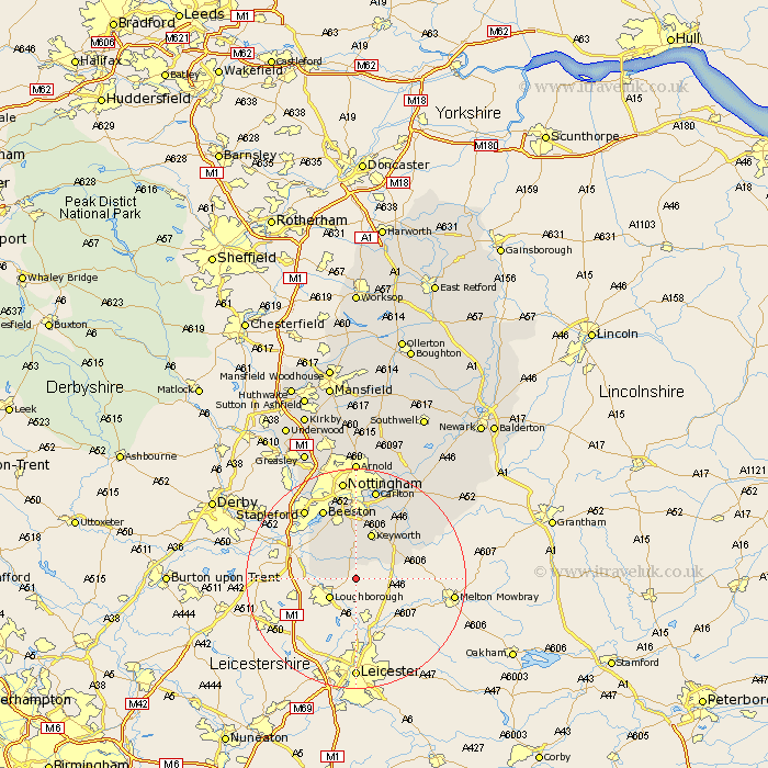
Nottinghamshire Map Showing Location of Rempstone
Population: 345
District: Rushcliffe
Easting: 458424 Northing: 322882
Latitude: 52.8 Longitude: -1.13
 = Rempstone
District: Rushcliffe
Easting: 458424 Northing: 322882
Latitude: 52.8 Longitude: -1.13
= Rempstone
This Rempstone map below is supplied by Google. Use the tools in the top left corner to zoom into street level or zoom out for a road map, you may also need to zoom in to see Rempstone on the map. Click and drag the map to move around. If the map fails to load try and refresh your browser or zoom in or out (+ or -).
Update - it seems Google no longer allow people to use their maps for free! This Rempstone map sometimes loads and sometimes gives a error. I am working on a solution.
Closest 30 Towns or Cities to Rempstone (Population over 500)
Costock 1.86km East Leake 2.91km Bunny 5.56km Gotham 7.14km Sutton Bonington 8.67km Ruddington 9.33km Kinoulton 11.51km Cotgrave 12.99km West Bridgford 13.02km West Bridgeford 13.02km Tollerton 13.4km Beeston 14.13km Cropwell Bishop 15km Stapleford 15.76km Radcliffe-on-Trent 16.27km Radcliffe 16.27km Radcliffe on Trent 16.27km Cropwell Butler 16.43km Cropwell 16.43km Carlton 17.01km Colwick 17.01km Trowell 17.92km Nottingham 18.67km Nottigham 18.67km Barnstone 19.21km Bingham 19.27km Shelford 20.12km Lambley 20.87km Cossall 21.09km Burton Joyce 21.46km