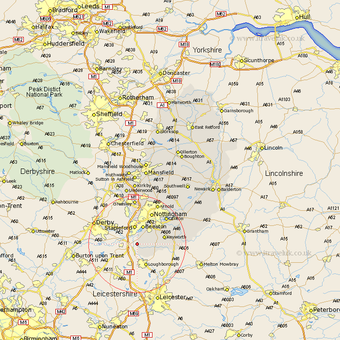
Nottinghamshire Map Showing Location of Ratcliffe On Soar
Population: 119
District: Rushcliffe
Easting: 450501 Northing: 328355
Latitude: 52.85 Longitude: -1.25
 = Ratcliffe On Soar
District: Rushcliffe
Easting: 450501 Northing: 328355
Latitude: 52.85 Longitude: -1.25
= Ratcliffe On Soar
This Ratcliffe On Soar map below is supplied by Google. Use the tools in the top left corner to zoom into street level or zoom out for a road map, you may also need to zoom in to see Ratcliffe On Soar on the map. Click and drag the map to move around. If the map fails to load try and refresh your browser or zoom in or out (+ or -).
Update - it seems Google no longer allow people to use their maps for free! This Ratcliffe On Soar map sometimes loads and sometimes gives a error. I am working on a solution.
Closest 30 Towns or Cities to Ratcliffe On Soar (Population over 500)
Sutton Bonington 1.86km Gotham 3.36km East Leake 6.71km Stapleford 7.5km Ruddington 7.67km Beeston 7.75km Bunny 7.83km Costock 8.67km Trowell 9.53km West Bridgford 11.62km West Bridgeford 11.62km Cossall 13.17km Tollerton 13.42km Nottingham 14.13km Nottigham 14.13km Kimberley 14.86km Awsworth 14.99km Cotgrave 15.57km Colwick 15.77km Carlton 15.77km Eastwood 17.01km Radcliffe-on-Trent 17.24km Radcliffe 17.24km Radcliffe on Trent 17.24km Kinoulton 17.91km Arnold 18.42km Greasley 18.57km Cropwell Bishop 18.74km Brinsley 19.07km Lambley 19.26km