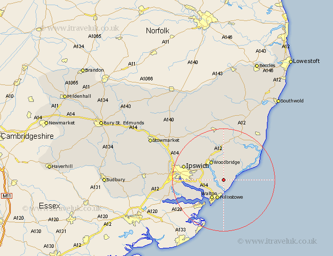
Suffolk Map Showing Location of Ramsholt
Population: 32
District: Suffolk Coastal
Easting: 632040 Northing: 242661
Latitude: 52.03 Longitude: 1.38
 = Ramsholt
District: Suffolk Coastal
Easting: 632040 Northing: 242661
Latitude: 52.03 Longitude: 1.38
= Ramsholt
This Ramsholt map below is supplied by Google. Use the tools in the top left corner to zoom into street level or zoom out for a road map, you may also need to zoom in to see Ramsholt on the map. Click and drag the map to move around. If the map fails to load try and refresh your browser or zoom in or out (+ or -).
Update - it seems Google no longer allow people to use their maps for free! This Ramsholt map sometimes loads and sometimes gives a error. I am working on a solution.
Closest 30 Towns or Cities to Ramsholt (Population over 500)
Hollesley 3.89km Sutton 4.36km Kirkton 5.88km Kirton 5.88km Felixstowe 7.75km Martlesham Heath 7.78km Martlesham 7.96km Walton 8.58km Melton 8.7km Woodbridge 8.7km Bucklesham 9.12km Rendlesham 9.55km Ufford 9.55km Nacton 10.43km Orford 11.66km Grundisburgh 11.75km Shotley 11.75km Tunstall 12.02km Chelmondiston 12.69km Wickham Market 13.03km Wirnesham 15.55km Witnesham 15.55km Ipswich 15.82km Holbrook 15.84km Otley 16.54km Stutton 17.61km Henley 18.45km Snape 18.48km Claydon 19.06km Sproughton 19.47km