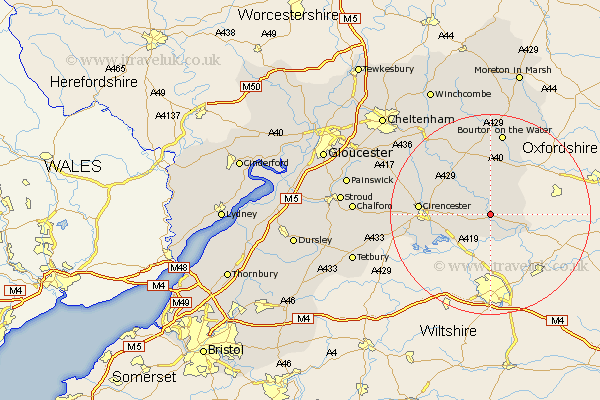
Gloucestershire Map Showing Location of Quenington
Population: 566
District: Cotswold
Easting: 414966 Northing: 202070
Latitude: 51.72 Longitude: -1.78
 = Quenington
District: Cotswold
Easting: 414966 Northing: 202070
Latitude: 51.72 Longitude: -1.78
= Quenington
This Quenington map below is supplied by Google. Use the tools in the top left corner to zoom into street level or zoom out for a road map, you may also need to zoom in to see Quenington on the map. Click and drag the map to move around. If the map fails to load try and refresh your browser or zoom in or out (+ or -).
Update - it seems Google no longer allow people to use their maps for free! This Quenington map sometimes loads and sometimes gives a error. I am working on a solution.
Closest 30 Towns or Cities to Quenington (Population over 500)
Fairford 1.86km Bibury 4.36km Kempsford 5.68km Lechlade 6.03km Ampney St. Peter 7.14km Ampney St Peter 7.14km Ampney 7.14km Ampney Saint Peter 7.14km Cerney 10.74km South Cerney 10.74km Siddington 12.07km Chedworth 13.04km Northleach 13.17km North Cerney 13.79km Cicester 13.9km Cirencester 13.9km Bourton on the Water 16.83km Bourton-on-the-Water 16.83km Withington 17.31km Andoversford 20.24km Bledington 21.2km Stow on the Wold 24.33km Stow-on-the-Wold 24.33km Charlton Kings 25.65km Chalford 26.47km Minchinhampton 26.48km Leckhampton 26.53km Avening 26.68km Tetbury 28.01km Shurdington 28.35km