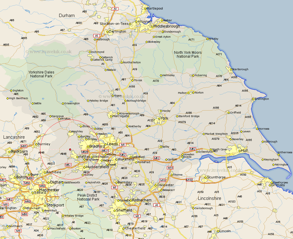
Yorkshire Map Showing Location of Queensbury
Population: 7220
Area Size (ha): 135
District: Bradford
Easting: 405492 Northing: 430066
Latitude: 53.77 Longitude: -1.92
 = Queensbury
Area Size (ha): 135
District: Bradford
Easting: 405492 Northing: 430066
Latitude: 53.77 Longitude: -1.92
= Queensbury
This Queensbury map below is supplied by Google. Use the tools in the top left corner to zoom into street level or zoom out for a road map, you may also need to zoom in to see Queensbury on the map. Click and drag the map to move around. If the map fails to load try and refresh your browser or zoom in or out (+ or -).
Update - it seems Google no longer allow people to use their maps for free! This Queensbury map sometimes loads and sometimes gives a error. I am working on a solution.
Closest 30 Towns or Cities to Queensbury (Population over 500)
Denholme 2.15km Oxenhope 4.3km Luddenden Foot 5.67km Cullingworth 5.67km Haworth 5.98km Wilsden 6.46km Hebden Bridge 6.83km Heptonstall 6.83km Mytholmroyd 7.08km Halifax 7.08km Bingley 10.76km Elland 10.77km Bradford 11.11km Ripponden 11.33km Brighouse 11.49km Todmorden 12.29km Shipley 12.32km Keighley 12.97km Steeton 13.15km Baildon 13.52km Sutton-in-Craven 13.68km Cleckheaton 14.28km Silsden 14.86km Huddersfield 15.67km Cornholme 15.79km Glusburn 15.8km Liversedge 16.07km Pudsey 16.53km Guiseley 17.21km Menston 17.69km