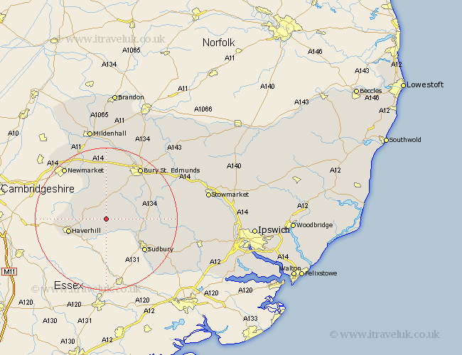
Suffolk Map Showing Location of Poslingford
Population: 183
District: St. Edmundsbury
Easting: 576853 Northing: 249680
Latitude: 52.12 Longitude: 0.58
 = Poslingford
District: St. Edmundsbury
Easting: 576853 Northing: 249680
Latitude: 52.12 Longitude: 0.58
= Poslingford
This Poslingford map below is supplied by Google. Use the tools in the top left corner to zoom into street level or zoom out for a road map, you may also need to zoom in to see Poslingford on the map. Click and drag the map to move around. If the map fails to load try and refresh your browser or zoom in or out (+ or -).
Update - it seems Google no longer allow people to use their maps for free! This Poslingford map sometimes loads and sometimes gives a error. I am working on a solution.
Closest 30 Towns or Cities to Poslingford (Population over 500)
Hundon 2.94km Clare 3.71km Wickhambrook 3.87km Cavendish 5.05km Glemsford 5.99km Chedburgh 7.75km Kedington 7.77km Chevington 9.54km Long Melford 10.67km Lawshall 10.89km Haverhill 10.9km Thurlow 11.38km Barrow 12.96km Sudbury 13.82km Cockfield 14.14km Waldingfield 14.75km Great Waldingfield 14.75km Lavenham 14.91km Gazeley 15.5km Great Cornard 15.59km Moulton 16.31km Rushbrooke 16.73km Risby 17.02km Bury St. Edmunds 17.39km Bury Saint Edmunds 17.39km Bury St Edmunds 17.39km Bradfield Saint George 17.44km Bradfield St. George 17.44km Bradfield 17.44km Bradfield St George 17.44km