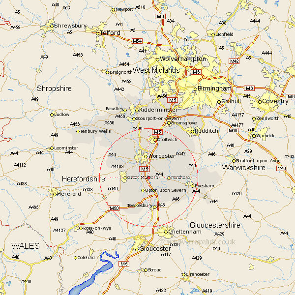
Worcestershire Map Showing Location of Pirton
Population: 169
District: Wychavon
Easting: 387448 Northing: 246548
Latitude: 52.12 Longitude: -2.18
 = Pirton
District: Wychavon
Easting: 387448 Northing: 246548
Latitude: 52.12 Longitude: -2.18
= Pirton
This Pirton map below is supplied by Google. Use the tools in the top left corner to zoom into street level or zoom out for a road map, you may also need to zoom in to see Pirton on the map. Click and drag the map to move around. If the map fails to load try and refresh your browser or zoom in or out (+ or -).
Update - it seems Google no longer allow people to use their maps for free! This Pirton map sometimes loads and sometimes gives a error. I am working on a solution.
Closest 30 Towns or Cities to Pirton (Population over 500)
Kempsey 2.17km Wadborough 2.28km Seven Stoke 2.94km Severn Stoke 2.94km Hanley Castle 5.05km Defford 5.88km Upton on Severn 6.01km Upton upon Severn 6.01km Upton-on-Severn 6.01km Upton 6.01km Peopleton 6.79km Powick 7.18km Eckington 7.19km Pershore 7.97km Malvern 9.1km Great Malvern 9.1km Ripple 9.27km Worcester 9.33km Crowle 10.32km Bredon 10.33km Welland 10.89km Malvern Wells 10.9km Fladbury 11.38km Leigh 11.73km Hallow 12.01km Castlemorton 12.23km Bishampton 12.66km Fernhill Heath 13.02km Cropthorne 13.06km Grimley 13.74km