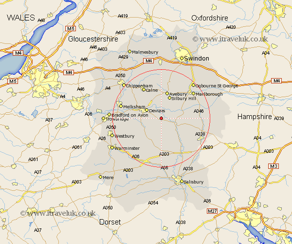
Wiltshire Map Showing Location of Patney
Population: 148
District: Kennet
Easting: 406968 Northing: 157570
Latitude: 51.32 Longitude: -1.9
 = Patney
District: Kennet
Easting: 406968 Northing: 157570
Latitude: 51.32 Longitude: -1.9
= Patney
This Patney map below is supplied by Google. Use the tools in the top left corner to zoom into street level or zoom out for a road map, you may also need to zoom in to see Patney on the map. Click and drag the map to move around. If the map fails to load try and refresh your browser or zoom in or out (+ or -).
Update - it seems Google no longer allow people to use their maps for free! This Patney map sometimes loads and sometimes gives a error. I am working on a solution.
Closest 30 Towns or Cities to Patney (Population over 500)
Urchfont 2.97km Bishops Cannings 6.56km Devizes 6.87km Upavon 6.88km Market Lavington 6.88km Lavington 6.88km Roundway 8.03km Potterne 8.11km Rowde 9.98km West Lavington 10.17km Enford 10.17km Pewsey 10.58km Worton 11.58km Cherhill 11.65km Erlestoke 12.17km Netheravon 12.32km Seend 13.26km Figheldean 13.77km Calne 14.71km Shrewton 14.83km Edington 14.98km Lark Hill 15.92km Bulford 15.95km Bratton 16.06km Burbage 16.32km Steeple Ashton 16.33km Marlborough 16.9km Melksham 17.13km Hilmarton 17.31km Hillmarton 17.31km