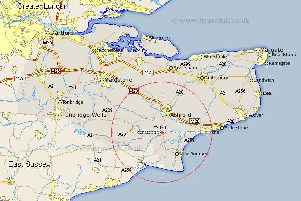
Kent Map Showing Location of Orlestone
Population: 1281
District: Ashford
Easting: 599660 Northing: 133630
Latitude: 51.07 Longitude: 0.85
 = Orlestone
District: Ashford
Easting: 599660 Northing: 133630
Latitude: 51.07 Longitude: 0.85
= Orlestone
This Orlestone map below is supplied by Google. Use the tools in the top left corner to zoom into street level or zoom out for a road map, you may also need to zoom in to see Orlestone on the map. Click and drag the map to move around. If the map fails to load try and refresh your browser or zoom in or out (+ or -).
Update - it seems Google no longer allow people to use their maps for free! This Orlestone map sometimes loads and sometimes gives a error. I am working on a solution.
Closest 30 Towns or Cities to Orlestone (Population over 500)
Ham Street 1.86km Rockinge 2.98km Ruckinge 2.98km Kingsnorth 3.7km Shadoxhurst 4.37km Woodchurch 5.82km Mersham 6.9km Aldington 7.23km Ashford 7.76km Bethersden 8.05km Hinxhill 9.42km High Halden 9.5km Hothfield 9.55km Kennington 9.55km Smeeth 9.86km Tenterden 10.48km New Romney 10.95km Sellindge 11.11km Sellinge 11.11km Dymchurch 11.87km Lympne 12.81km Brabourne 12.83km Wittersham 12.85km Lydd 13.79km Smarden 13.8km Wye 14.21km Pluckley 14.72km Charing 15.23km Egerton 15.31km Biddenden 15.58km