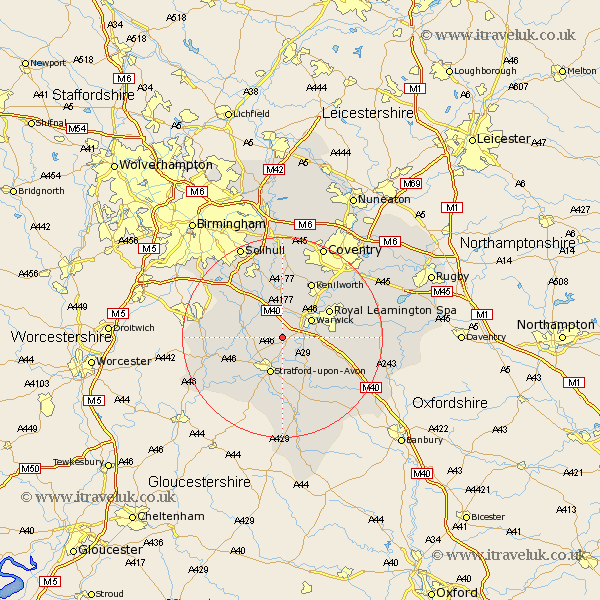
Warwickshire Map Showing Location of Norton Lindsey
Population: 310
District: Warwick
Easting: 422753 Northing: 261409
Latitude: 52.25 Longitude: -1.67
 = Norton Lindsey
District: Warwick
Easting: 422753 Northing: 261409
Latitude: 52.25 Longitude: -1.67
= Norton Lindsey
This Norton Lindsey map below is supplied by Google. Use the tools in the top left corner to zoom into street level or zoom out for a road map, you may also need to zoom in to see Norton Lindsey on the map. Click and drag the map to move around. If the map fails to load try and refresh your browser or zoom in or out (+ or -).
Update - it seems Google no longer allow people to use their maps for free! This Norton Lindsey map sometimes loads and sometimes gives a error. I am working on a solution.
Closest 30 Towns or Cities to Norton Lindsey (Population over 500)
Claverdon 2.93km Barford 4.9km Bearley 4.9km Snitterfield 4.9km Shrewley 5.56km Hatton 5.68km Warwick 6.77km Wootton Wawen 6.81km Henley in Arden 7.75km Rowington 7.76km Stratford on Avon 7.76km Stratford-upon-Avon 7.76km Stratford-on-Avon 7.76km Stratford 7.76km Stratford upon Avon 7.76km Aston Cantlow 9.27km Bishops Tachbrook 9.27km Wellesbourne Hastings 9.34km Wellesbourne 9.34km Whitnash 10.21km Leamington 10.64km Royal Leamington Spa 10.64km Leamington Spa 10.64km Lapworth 10.86km Great Alne 10.87km Ullenhall 11.62km Kenilworth 12.48km Temple Balsall 13.03km Lighthorne 13.56km Ettington 13.75km