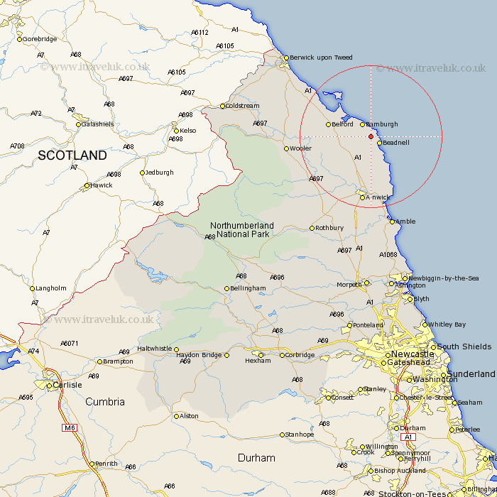
Northumberland Map Showing Location of North Sunderland
Population: 1790
Area Size (ha): 70
District: Berwick-upon-Tweed
Easting: 421018 Northing: 630387
Latitude: 55.57 Longitude: -1.67
 = North Sunderland
Area Size (ha): 70
District: Berwick-upon-Tweed
Easting: 421018 Northing: 630387
Latitude: 55.57 Longitude: -1.67
= North Sunderland
This North Sunderland map below is supplied by Google. Use the tools in the top left corner to zoom into street level or zoom out for a road map, you may also need to zoom in to see North Sunderland on the map. Click and drag the map to move around. If the map fails to load try and refresh your browser or zoom in or out (+ or -).
Update - it seems Google no longer allow people to use their maps for free! This North Sunderland map sometimes loads and sometimes gives a error. I am working on a solution.
Closest 30 Towns or Cities to North Sunderland (Population over 500)
Beadnell 2.8km Embleton 9.79km Belford 11.11km Alnwick 18.66km Almwick 18.66km Alnmouth 19.01km Lowick 20.25km Lisburg 20.64km Lesbury 20.64km Wooler 21.29km Shilbottle 22.26km Warkworth 24.3km Ancroft 25.64km Amble 26.48km Swarland 29.95km Ord 29.96km East Ord 29.96km Rothbury 31.45km Thirston 31.53km East Thirston 31.53km Felton 31.58km Berwick upon Tweed 31.89km Berwick-Upon-Tweed 31.89km Berwick on Tweed 31.89km Berwick 31.89km Berwick-upon-Tweed 31.89km Berwick-on-Tweed 31.89km East Chevington 31.95km Longframlington 32.36km Norham 34.61km