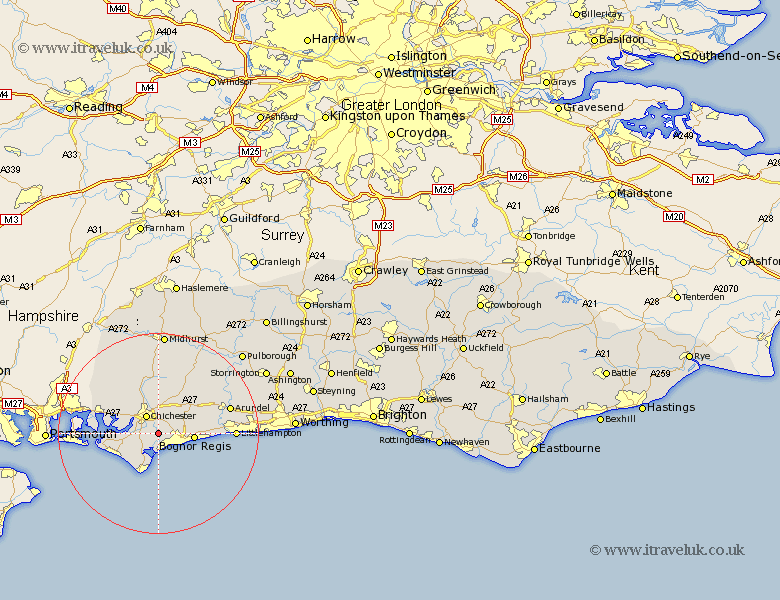
Sussex Map Showing Location of North Mundham
Population: 1171
District: Chichester
Easting: 488078 Northing: 100856
Latitude: 50.8 Longitude: -0.75
 = North Mundham
District: Chichester
Easting: 488078 Northing: 100856
Latitude: 50.8 Longitude: -0.75
= North Mundham
This North Mundham map below is supplied by Google. Use the tools in the top left corner to zoom into street level or zoom out for a road map, you may also need to zoom in to see North Mundham on the map. Click and drag the map to move around. If the map fails to load try and refresh your browser or zoom in or out (+ or -).
Update - it seems Google no longer allow people to use their maps for free! This North Mundham map sometimes loads and sometimes gives a error. I am working on a solution.
Closest 30 Towns or Cities to North Mundham (Population over 500)
North Mundham 0km Mundham 0km Donnington 2.34km Dunnington 2.34km Sidlesham 2.99km Pagham 3.7km Chichester 4.38km Oving 4.38km Bersted 5.04km Fishbourne 5.1km Boxgrove 6.03km Tangmere 6.03km Lavant 6.03km Birdham 6.14km Bognor Regis 7.07km Bognor 7.27km Felpham 7.27km Selsey 7.78km Eastergate 7.94km Westergate 8.19km Barnham 8.41km Bosham 8.41km Middleton-on-Sea 9.55km Middleton on Sea 9.55km Middleton 9.55km Slindon 9.9km East Wittering 10.08km West Thorney 10.54km Yapton 10.54km Walberton 10.89km