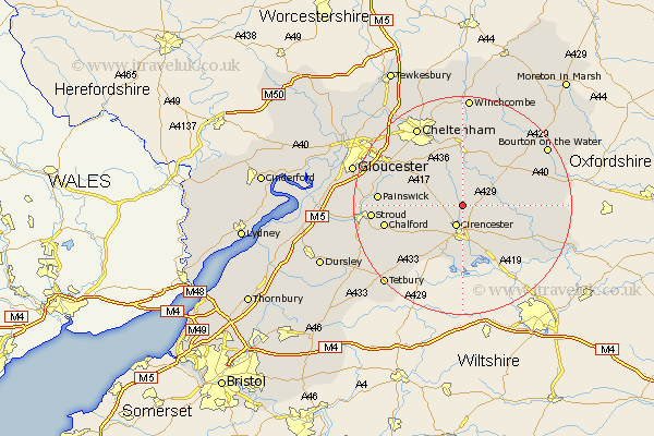
Gloucestershire Map Showing Location of North Cerney
Population: 558
District: Cotswold
Easting: 402299 Northing: 207608
Latitude: 51.77 Longitude: -1.97
 = North Cerney
District: Cotswold
Easting: 402299 Northing: 207608
Latitude: 51.77 Longitude: -1.97
= North Cerney
This North Cerney map below is supplied by Google. Use the tools in the top left corner to zoom into street level or zoom out for a road map, you may also need to zoom in to see North Cerney on the map. Click and drag the map to move around. If the map fails to load try and refresh your browser or zoom in or out (+ or -).
Update - it seems Google no longer allow people to use their maps for free! This North Cerney map sometimes loads and sometimes gives a error. I am working on a solution.
Closest 30 Towns or Cities to North Cerney (Population over 500)
Cicester 3.89km Cirencester 3.89km Chedworth 5.05km Withington 7.49km Siddington 9.34km Ampney St. Peter 9.38km Ampney Saint Peter 9.38km Ampney St Peter 9.38km Ampney 9.38km Bibury 10.49km Andoversford 11.18km Cerney 11.64km South Cerney 11.64km Northleach 12.7km Charlton Kings 13.07km Leckhampton 13.71km Quenington 13.79km Chalford 14.26km Fairford 14.64km Painswick 15.02km Shurdington 15.16km Minchinhampton 15.64km Stroud 16.17km Brockworth 16.58km Avening 16.61km Cheltenham 16.85km Hucclecote 17.54km Kempsford 17.71km Nailsworth 18.55km Bourton-on-the-Water 18.58km