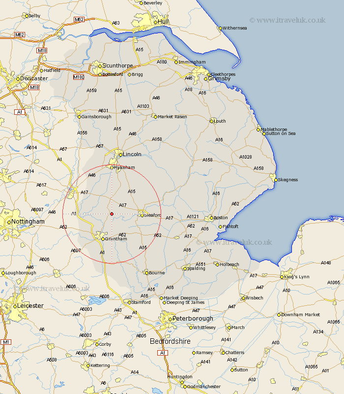
Lincolnshire Map Showing Location of Normanton
Population: 96
District: South Kesteven
Easting: 495061 Northing: 345714
Latitude: 53 Longitude: -0.58
 = Normanton
District: South Kesteven
Easting: 495061 Northing: 345714
Latitude: 53 Longitude: -0.58
= Normanton
This Normanton map below is supplied by Google. Use the tools in the top left corner to zoom into street level or zoom out for a road map, you may also need to zoom in to see Normanton on the map. Click and drag the map to move around. If the map fails to load try and refresh your browser or zoom in or out (+ or -).
Update - it seems Google no longer allow people to use their maps for free! This Normanton map sometimes loads and sometimes gives a error. I am working on a solution.
Closest 30 Towns or Cities to Normanton (Population over 500)
Caythorpe 2.17km Fulbeck 3.7km Ancaster 4.99km Belton 7.5km Welbourn 7.74km Cranwell 8.64km Claypole 10.7km Great Gonerby 10.81km Heasingham 11.3km Leasingham 11.3km Brauncewell 11.47km Allington 11.61km Wellingore 11.61km Grantham 11.61km Sleaford 11.62km Long Bennington 11.76km Navenby 11.98km Barrowby 12.98km Bassingham 13.4km Ropsley 13.72km Buskington 13.88km Ruskington 13.88km Bloxholme 14.49km Bloxholm 14.49km Harlaxton 16.27km Scopwick 16.55km Aubourn 16.83km Digby 17.19km Swinderby 18.41km Waddington 18.84km