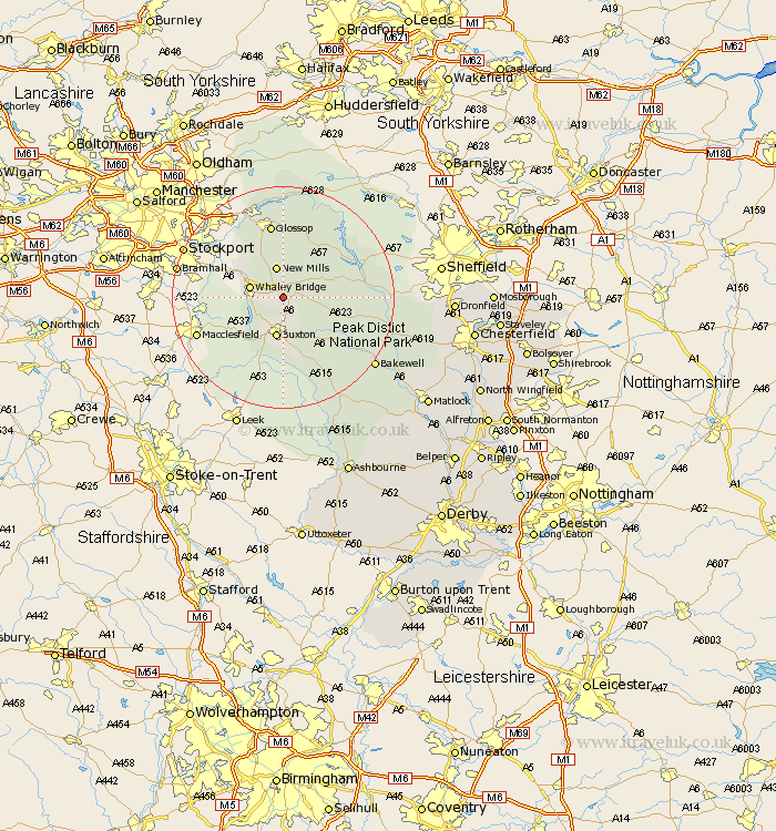
Derbyshire Map Showing Location of Chapel En Le Frith
Population: 8519
Area Size (ha): 228
District: High Peak
Easting: 406661 Northing: 380009
Latitude: 53.32 Longitude: -1.9
 = Chapel En Le Frith
Area Size (ha): 228
District: High Peak
Easting: 406661 Northing: 380009
Latitude: 53.32 Longitude: -1.9
= Chapel En Le Frith
This Chapel En Le Frith map below is supplied by Google. Use the tools in the top left corner to zoom into street level or zoom out for a road map, you may also need to zoom in to see Chapel En Le Frith on the map. Click and drag the map to move around. If the map fails to load try and refresh your browser or zoom in or out (+ or -).
Update - it seems Google no longer allow people to use their maps for free! This Chapel En Le Frith map sometimes loads and sometimes gives a error. I am working on a solution.
Closest 30 Towns or Cities to Chapel En Le Frith (Population over 500)
New Mills 5.67km Whaley Bridge 5.83km Buxton 7.5km Hayfield 8.12km Castleton 9.05km Bradwell 9.96km Tideswell 10.46km Hope 10.63km Glossop 13.49km Charlesworth 14.56km Bamford 14.86km Eyam 15.94km Great Longstone 16.21km Longstone 16.21km Hathersage 16.61km Tintwistle 17.25km Tintwhistle 17.25km Stony Middleton 17.52km Stoney Middleton 17.52km Grindleford 18.11km Grindleford Bridge 18.11km Bakewell 20.23km Middleton 20.66km Baslow 21km Youlgreave 21.34km Holmesfield 25.74km Darley Dale 26.01km Winster 26.32km Old Brampton 28.17km Brampton 28.17km