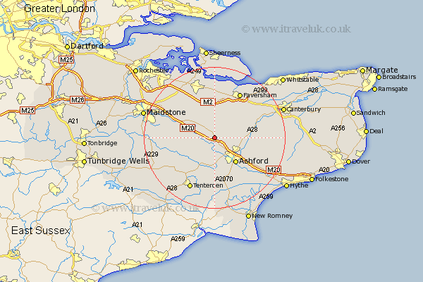
Kent Map Showing Location of Charing
Population: 2694
District: Ashford
Easting: 595593 Northing: 148315
Latitude: 51.2 Longitude: 0.8
 = Charing
District: Ashford
Easting: 595593 Northing: 148315
Latitude: 51.2 Longitude: 0.8
= Charing
This Charing map below is supplied by Google. Use the tools in the top left corner to zoom into street level or zoom out for a road map, you may also need to zoom in to see Charing on the map. Click and drag the map to move around. If the map fails to load try and refresh your browser or zoom in or out (+ or -).
Update - it seems Google no longer allow people to use their maps for free! This Charing map sometimes loads and sometimes gives a error. I am working on a solution.
Closest 30 Towns or Cities to Charing (Population over 500)
Pluckley 3.95km Egerton 5km Hothfield 5.68km Lenham 6.88km Doddington 7.77km Kennington 8.04km Harrietsham 8.93km Ashford 9.42km Wye 9.47km Bethersden 9.55km Ulcombe 10.45km Selling 11km Smarden 11.01km Linsted 11.18km Lynsted 11.18km Shadoxhurst 11.18km Kingsnorth 11.65km Hollingbourne 11.83km Hinxhill 11.89km Ospringe 12.05km Chilham 12.18km Bredgar 13.12km Bapchild 13.18km Leeds 13.3km Headcorn 13.94km Oare 14.21km Tunstall 14.21km High Halden 14.22km Mersham 14.5km Faversham 14.72km