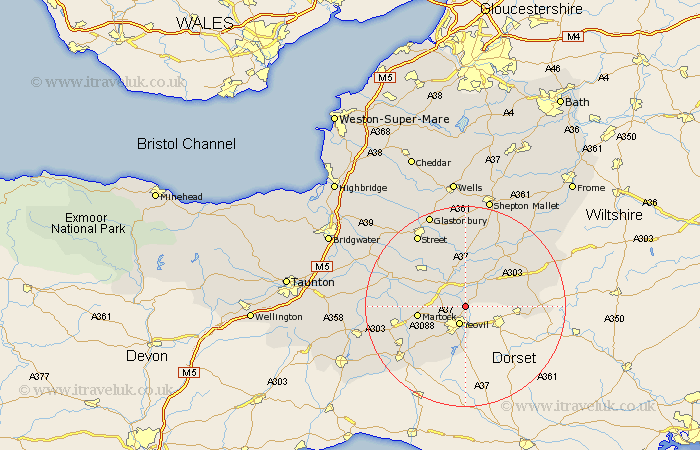
Somerset Map Showing Location of Mudford
Population: 656
District: South Somerset
Easting: 356717 Northing: 120674
Latitude: 50.98 Longitude: -2.62
 = Mudford
District: South Somerset
Easting: 356717 Northing: 120674
Latitude: 50.98 Longitude: -2.62
= Mudford
This Mudford map below is supplied by Google. Use the tools in the top left corner to zoom into street level or zoom out for a road map, you may also need to zoom in to see Mudford on the map. Click and drag the map to move around. If the map fails to load try and refresh your browser or zoom in or out (+ or -).
Update - it seems Google no longer allow people to use their maps for free! This Mudford map sometimes loads and sometimes gives a error. I am working on a solution.
Closest 30 Towns or Cities to Mudford (Population over 500)
Yeovil 3.88km Yeovilton 3.96km Queen Camel 4.39km Ilchester 5.02km Sparkford 6.57km Tintinhull 7.24km Montacute 7.92km West Coker 8.76km North Cadbury 8.94km Martock 9.52km Charlton Mackrell 9.91km Milborne Port 10.66km Long Sutton 11.13km Somerton 11.92km West Chinnock 11.92km Kingsbury 12.83km Kingsbury Episcopi 12.83km Castle Cary 13.14km Haselbury Plucknett 13.16km Barton St David 13.18km Barton Saint David 13.18km Barton St. David 13.18km South Petherton 13.36km Butleigh 13.79km Compton 14.74km Baltonsborough 15.01km Henstridge 15.28km Ditcheat 15.94km Langport 16.15km High Ham 16.78km