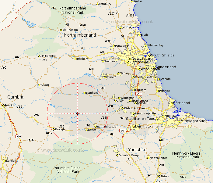
Durham Map Showing Location of Middleton In Teesdale
Population: 1156
District: Teesdale
Easting: 394619 Northing: 524632
Latitude: 54.62 Longitude: -2.08
 = Middleton In Teesdale
District: Teesdale
Easting: 394619 Northing: 524632
Latitude: 54.62 Longitude: -2.08
= Middleton In Teesdale
This Middleton In Teesdale map below is supplied by Google. Use the tools in the top left corner to zoom into street level or zoom out for a road map, you may also need to zoom in to see Middleton In Teesdale on the map. Click and drag the map to move around. If the map fails to load try and refresh your browser or zoom in or out (+ or -).
Update - it seems Google no longer allow people to use their maps for free! This Middleton In Teesdale map sometimes loads and sometimes gives a error. I am working on a solution.
Closest 30 Towns or Cities to Middleton In Teesdale (Population over 500)
Cotherstone 8.51km Barnard Castle 14.19km Startforth 14.19km Stanhope 15.43km Wolsingham 17km Cockfield 18.24km Staindrop 19.08km Evenwood 20.39km Tow Law 21.5km Etherley 21.77km High Etherley 21.77km West Auckland 22.61km Gainford 23.74km Crook 24.34km Willington 27.04km Bishop Auckland 27.07km Cornsay 27.52km Castleside 27.81km Shildon 27.96km Coundon 28.43km Consetti 30.51km Consett 30.51km Esh 30.82km Lanchester 31.62km Spennymoor 32.42km Leadgate 33.22km Newton Aycliffe 33.27km Ushaw Moor 33.44km Brandon 33.46km Langley Park 33.64km